
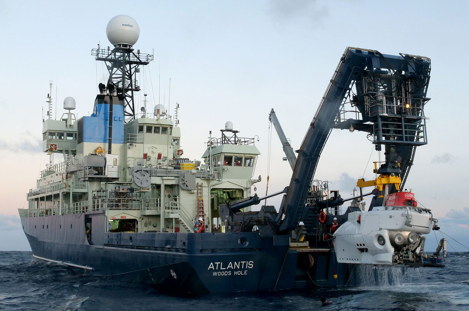
Scientists from Woods Hole have completed some of the most detailed surveys on shipwrecks tied to two storied Antarctic explorers.
Researchers with the Woods Hole Oceanographic Institution (WHOI) departed the Falmouth port last month for the three-week trip to the Labrador Sea off the coast of Greenland. With the help of the Royal Canadian Geographical Society, the researchers took 3-D images of the Quest, the final ship of Ernest Shackleton, and Terra Nova, the former ship of Antarctic explorer Robert Falcon Scott.
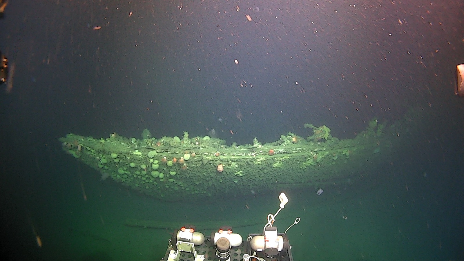
The trip resulted in the first comprehensive visual surveys of both vessels, and the teams hope the newly created digital renderings of the wrecks will help the public learn about these historic vessels at the bottom of the ocean.
“There’s a lot of scientific interest, both historically and archeologically,” said Dwight Coleman, an ocean exploration and imaging technologist at WHOI who embarked on the expedition. “We want to tell the story of these explorers, the people that operated these ships, the crew of these ships and the missions that these ships were on to really spread that word to the public and bring recognition to this age of exploration.”
Researchers also believe the trips will lead to a better understanding of the degradation process of wrecks and how it affects the nearby ecosystem.
“We’re going to utilize the high-resolution 3-D models of the wrecks for more than just visualization, but also to make them serve as foundational data for advanced engineering simulations,” said Anna Maiya Norling, an archaeologist on the trip who works with the Njord Center and the National Museum of Denmark.
Ms. Norling was one of two others aboard Alvin, the WHOI submersible that was used to survey the Titanic in 1986, during one of the dives on Terra Nova.
While observing the Terra Nova wreck through Alvin’s small windows, she was struck by how poorly the site was preserved. Ms. Norling and the rest of the crew could see into the internal structure of the ship’s hull through the bow. The deck was completely gone. The ship’s bow had been split open and much of the structure had collapsed into the seabed. It looked like a coconut, Ms. Norling remembered one of her colleagues saying.
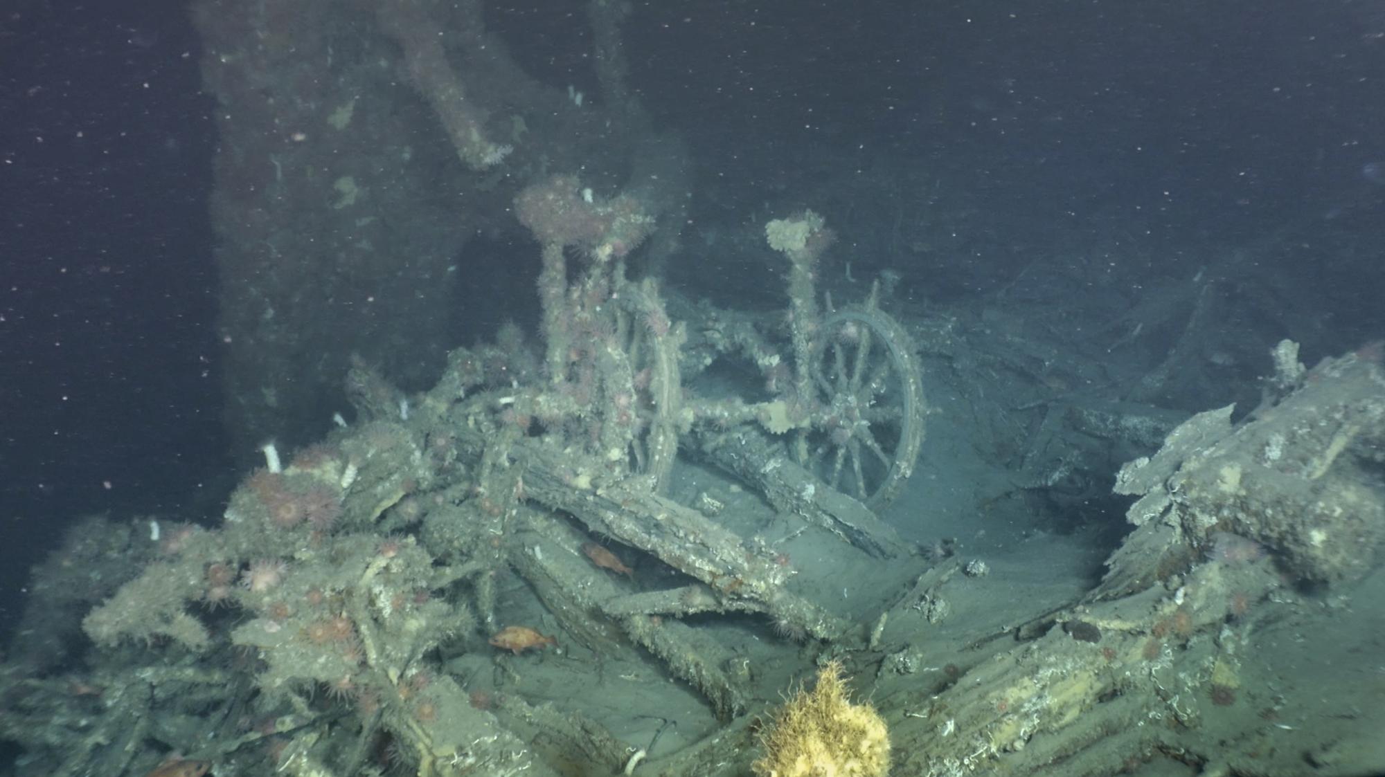
“The opening of the hull revealed details about the ship’s design and construction that would otherwise have remained concealed,” said Ms. Norling. “So, the damage has kind of provided us with a cross section of the wreck.”
In addition to Alvin, researchers piloted a remote-controlled submersible. While Alvin allowed for a crew to inspect and study both wrecks in person, the remotely-operated vehicle enabled the team to capture images from hard-to-reach angles. The images captured from both vessels will paint a more accurate representation of the wrecks and the rate of their decay.
“We will combine the empirical data on chemical corrosion and biological decay to then predict the future strength and structural integrity of these vessels,” said Ms. Norling.
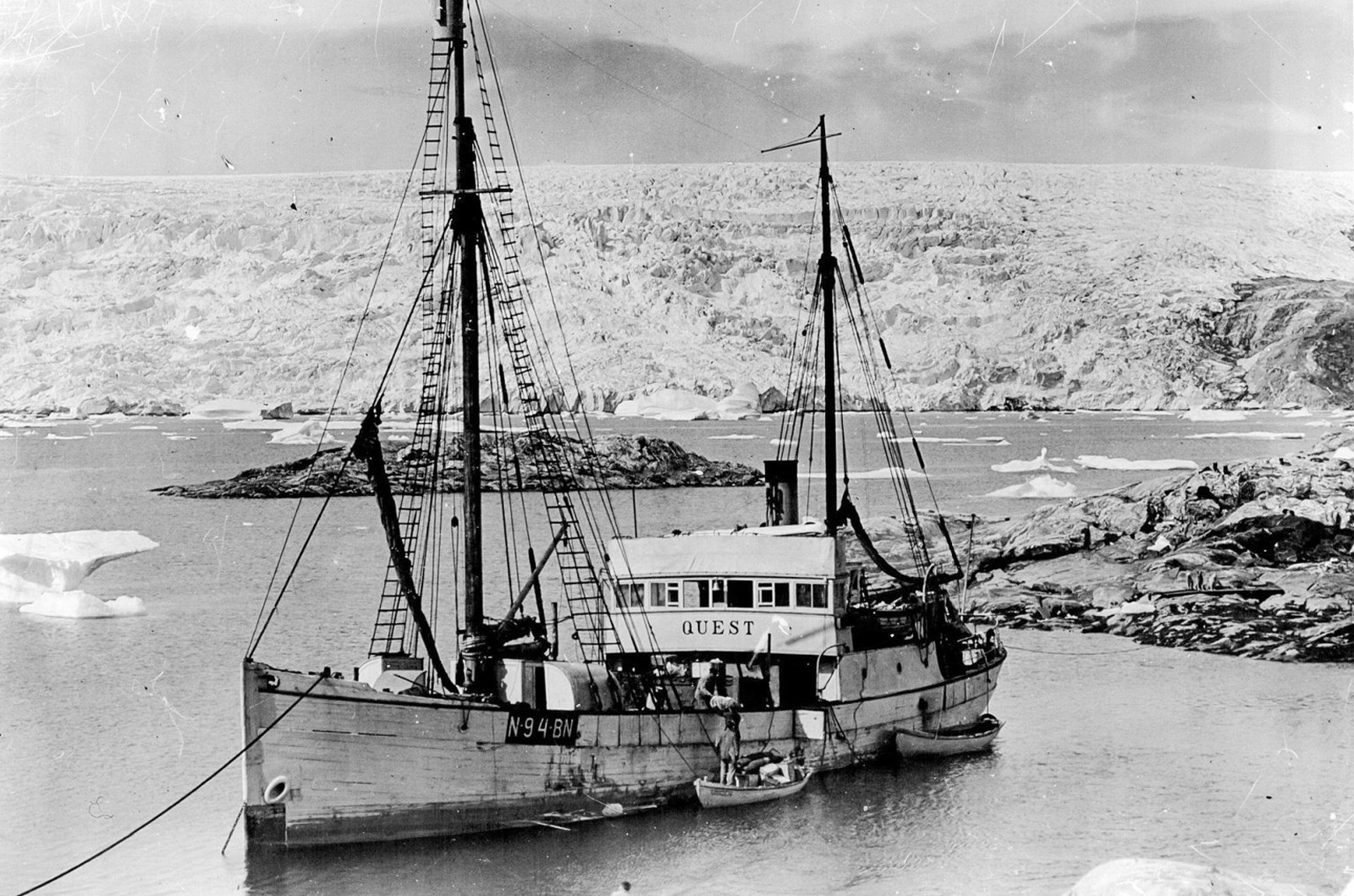
Built in 1917 in Risør, Norway, Quest was originally designed to function as a sealing vessel. It was later repurposed to serve the famed explorer Ernest Shackleton on his last voyage to the polar south.
Terra Nova, which means ‘New Land’ in Latin, was built in Dundee, Scotland, in 1884. Like Quest, it was designed for sealing and whaling. After a short stint serving in the Labrador Sea with the Dundee sealing and whaling fleet, it was procured by Robert Falcon Scott in 1909 and was used by him during a failed expedition to Antarctica that occurred between 1910 and 1913.
While Mr. Scott’s expedition was successful in reaching the South Pole, an expedition led by Norwegian explorer Roald Amundsen had already reached the pole 34 days before, making him, and not Mr. Scott,the first recorded human to reach the bottom of the world. Mr. Scott and the other four members of his crew died soon after they arrived at the South Pole.
Mr. Shackleton was never able to make landfall on Antarctica with Quest due to the ship’s inability to navigate the icy waters surrounding the continent. Mr. Shackleton became famous for surviving the cold Antarctic climates during an expedition on another ship, Endurance.
“These ships still are some of the most technologically advanced things that humans built back in the day of early polar exploration,” said Mr. Coleman. “You couldn’t have done it without the ships. That is how you got people there. That’s how you held to the standards of human safety and human life.”
Quest was sunk on May 5, 1962, many years after Shackleton died from a heart attack at the age of 47 while aboard the vessel, after constricting ice flows penetrated its hull during a sealing expedition. Although the ship was lost, the entire crew was saved.
While Quest met a similar fate as the Endurance, Terra Nova was purposely scuttled on September 13, 1943, after a voyage to resupply stations located in Newfoundland. According to a declassified report filed by the U.S. Coast Guard, Terra Nova was set ablaze and was later sunk with gunfire after the crew had abandoned the vessel and were rescued.
Both ships now lay preserved in the cold waters of the Labrador sea and are now teeming with marine life.
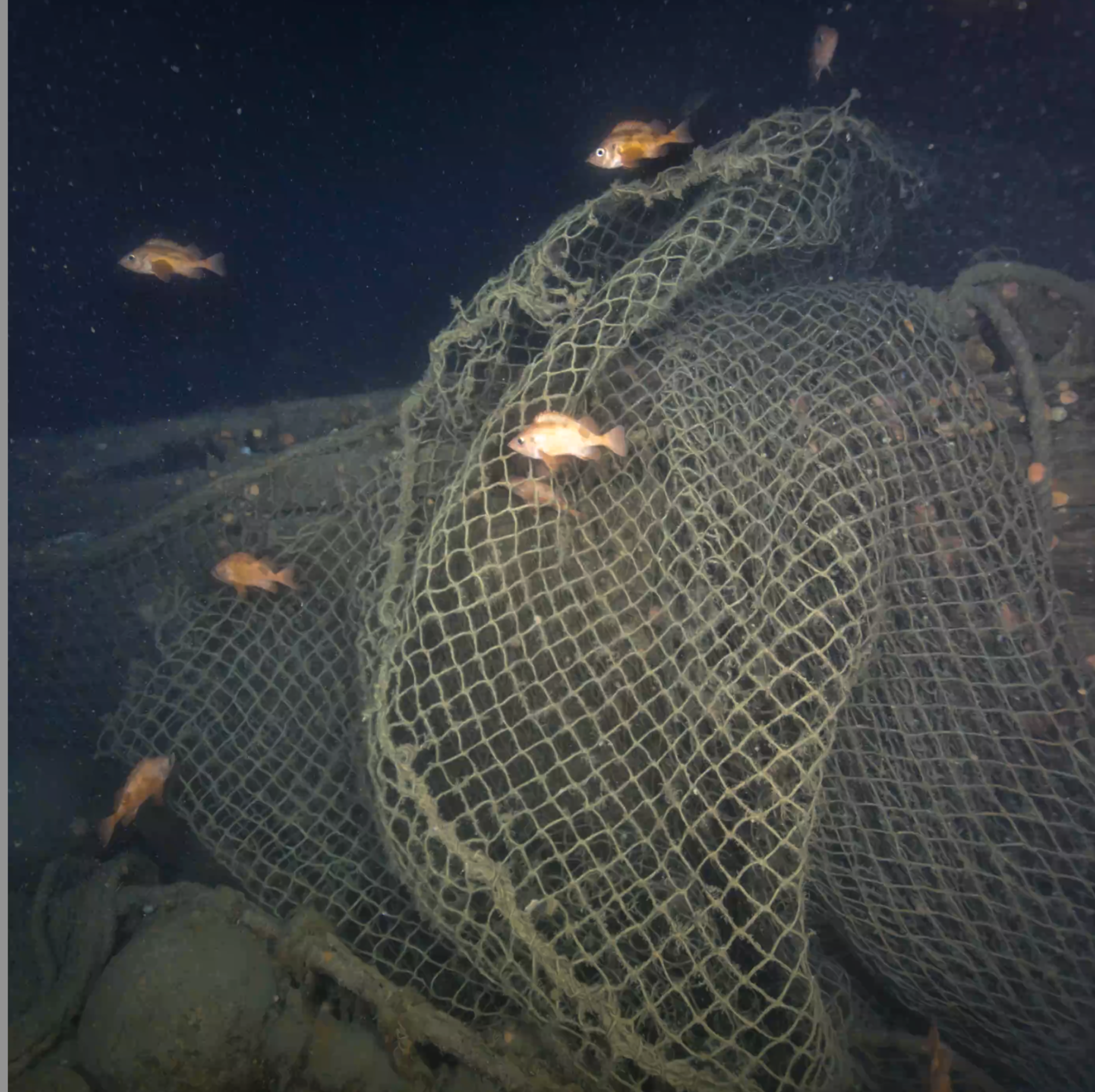
In addition to capturing 3-D imagery of the wrecks, the expedition sought to study the damages to marine ecosystems from trawling and fishing activity, said Mr. Coleman.
Schools of cod were observed by researchers swimming along cold-water coral, which had developed among refuse that now lays draped and tangled upon the wrecks after decades of commercial fishing in the area.
“That’s an interesting thing in the world of marine debris and trying to understand hazards to fishing and how to handle the debris that’s created by such activities,” he said.
The two wrecks have a lot in common, according to the researchers. Both were built during the golden age of Antarctic exploration and both were piloted by historic figures of the era who dreamed of leaving their fingerprint on the polar continent.
Today, the wrecks provide a unique look into the effects of degradation on the sea floor. The 3-D models generated from images captured of the sites can be used to study the deteriorating state of the sites
According to Ms. Norling, the two wrecks surveyed during the expedition were in high states of entropy, meaning that the rate of degradation is increasing. Likely driven by the effects of climate change, the wrecks will continue to break down and, over time, will degrade completely.
“There’s still much to lose if natural or human-induced triggers accelerate,” she said.
The models rendered from photogrammetric imagery taken during the expedition will be accessible to the public to facilitate further research opportunities.





Comments
Comment policy »