


Gifford’s Store, as most persons of mature age would call it, still stands on the West Tisbury-Edgartown road, which highway developed from the ancient Mill Path, whereby Edgartown settlers walked or rode to the mill on the Mill River, to have their corn ground.
There are people, not too numerous, who will recall that this was once Rotch’s Store, and they will recall the stout, and genial though determined gentleman who was once the proprietor, and who served as a selectman of West Tisbury for nigh half his lifetime. His home, which was on the ancient road which originally was but a path between the original home sites of the village, still stands, although it is almost forgotten that for fifty years the meetings of the town board of selectmen were held n its parlor.
At the intersection of these two roads, there is a tiny grass-plot, narrowed on all of its three sides by improvements to the highways, which is a pity, because this is one of the few remaining spots on the Vineyard which carries a special historical significance.
Loyal to King and Country
This was the original “King’s Land” in the brand new town of Tisbury which, incorporated in 1671, had been nevertheless, a thriving settlement for a number of years before that and, enterprising as well as loyal to king and country, had established all the institutions common to the English town or manor of that day.
Therefore, on one side of this intersection, the nearest thing to a crossroad that the village could boast, was the town jail. On the other was the court house, and between, on the grass-plot, the village square in miniature, stood the whipping-post and stocks ready to receive malefactors, should any be brought to justice. There should have been a gallows or gibbet too, in order to complete the picture, but there is reason to believe that the colonial Governor Mayhew was unwilling to allow this new town to handle capital cases in its court, and possibly he felt that if there were to be executions, his original town, Edgartown, and the seat of Island government, was a more proper place for such matters. His own gallows, erected on Tower Hill, was in readiness for such business as might come before the “Honorable, the Justices,” who represented his gracious Majesty, the King, “God Bless Him,” and so far as is known, it was never put to any use.
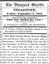
But Tisbury, sometimes called Newtown, appeared to have been well satisfied with what it had by way of representation of the kings’ justice, and took steps to perpetuate the fact that law and order prevailed in the village, said steps, incidentally, having nearly failed of their purpose, as will be explained. For the old road, as this way has been called, was originally the Court House Road and is so designated in the old deeds.
Article With a Purpose
The article, then, is written with the idea and the hope that the name may be revived and restored, in place of Old County Road. Yes, even that a sign, one of the decorated signs of the Commonwealth, be affixed in a prominent place to make known to all the significance of the highway, and of the other features which mark its historical beginning.
History states that the original village of Tisbury, located in a part of what is now West Tisbury, was incorporated, as mentioned, in 1671. It further states that authorization for the purchase of the greater portion of the present township was granted “unto William Pabodie, James Skiffe, Josias Standish and James Allin,” by Governor Mayhew, in 1668. But it also states that this authorization also confirmed previous purchases of land by these patentees of Tisbury, and a perusal of old deeds will show that Allin’s first purchase was recorded in 1658, while the date on the fireplpace bricks of his second house in the township was 1652.
All this makes it a trifle difficult to ascertain just how and when Tisbury really began. But this much is clear, that the original homesites lay in a double row on both sides of the western end of Court House Road. Several of these homesites can be identified at the present day, with boundaries intact and, undoubtedly, bricks and lime from the original habitations lying somewhere beneath the grass and turf of the yards.
Originally a path, at most, running fairly straight between the rows of houses, yet becoming something of a road as soon as draft animals made their appearance, it is referred to as the “Old Road” as early as 1671, and definitely located as the original Main Street of the town. Naturally all of this became rather insignificant as years passed and the center of population shifted to what is now Vineyard Haven, and by the time the separation of the town had taken place and West Tisbury had been incorporated in 1892, there were not many people who knew the story of the King’s Land. And as for the road, it had already been called by many names, including “Scotchman’s Bridge Road,” which actually is but a short cross-road, connecting Court House Road with the State Highway at some distance form the village.
Grass-Grown Sites
The court house and jail were discontinued insofar as their original use was concerned, and while one eventually became a doctor’s office and the other an ice-house, these changes involved moving the buildings, and very few people know whether or not they still stand or what end they made. The original sites became grass-grown and the foundations disappeared, either moved or buried until, as now, the history of this spot and its significance as a landmark have well nigh been lost, together with the name of the road, of which the old Tisbury elders were justly proud.
There is further history on this road if it is sought, in at least a couple of dwellings there. One glance at the home of Mrs. Thomas Cooper, somewhat to the east of the court house site, is sufficient to identify it as a house of extreme age. Often designated as the oldest house in the town, it may be the oldest in the original township, which would include Tisbury as well. Certainly it bears characteristics, both inside and out, which might establish its age at more than two centuries. It has experienced that great amount of living which makes a house a home, as the poet has said, and there is a warmth and mellowness about it that makes every detail of its simple architecture a delight to the eye.
Characteristically, the second old house on this road retains something of the stiffness of the pride and aloofness of its original occupant, although many people would find it beautiful in all ways. Certainly it is massively constructed, and as the present home of Mr. and Mrs. Alfred Churchill and their family, it is a home in every respect.
A Man of Substance
But standing miles away from its present site was the home of Colonel John Allen, sheriff, justice of the court of common please, and the proprietor of an Indian trading post. It took the place of an inn again and again, as journals of early travelers serve to show, and was in and of itself, an indication of wealth, power, and the majesty of law, even in 1720, when, as records show, the colonel occupied it with his whole family.
Only a huge lilac bush and a few tumbled stones mark the original site of this house, far up the South Road, in Chilmark. The old stone wall which enclosed the front yard on one side, still stands, being a property boundary wall. The horse-block, a rock into which a step had been broken or cut, graces the grounds of a mainland resident. The huge mortar which stood in the rear, where the colonel employed Indians to “work out” their bills, has also been transplanted to serve as a decoration. Far better perhaps, that these landmarks should be removed than to find their way into foundations or cesspools and be entirely forgotten.
But as to what transpired in that old house, what sort of life was lived there, the annals of Island towns contained in Banks’ History of Martha’s Vineyard, contain many excerpts from journals and diaries of travelers who “stopped for the night at Sheriff Allen’s, and proceeded by horse to Gay Head and the Indian village,” or “to Lumbert’s Cove, to embark on the packet.”
Gay Head Pasturage
“Ye Indians of Gay Head hath agreed toe the pasturage of seven cattle to pay for merchandise purchased.”
“To Ecobod Allen (his brother) seven pence for bridle leather.”
“Toe Elisha Howasswee, seven pence for speaking to the judge for you.”
Thus it may be learned that Colonel Allen had a finger in various pies and that he was a power to be reckoned with. And small wonder, for the extremely select Mayhew family ruling the Island, had allowed him to marry one of the daughters, the first marriage into the Mayhew family recorded. This placed the colonel very close to government and apparently he took advantage of the fact.
Yet all this is in serious danger of being forgotten, and the grouping of so much history upon this old highway is sufficient reason in itself for reviving the name of Court House Road, and making an effort to prevent the historical significance of the place and its surroundings from again slipping so very close to oblivion.
There are not so many people left who may call themselves descendants of those who founded this town, who laid out the homesites or the old road. But even though there may be no blood kin left in days to come, the traditions are worthy, the history valuable, and the sentiment, if it shall survive, may well gain in strength. Certainly the correct marking of Court House Road should do much to preserve the knowledge of all that it may signify.


Comments