Erosion
2013
With storm season on the way and East Chop Drive in a compromised state, the town of Oak Bluffs is considering whether to close the scenic roadway.
At a meeting nearly two weeks ago, the East Chop Association voted to recommend that the road be closed between Brewster and Munroe avenues.
The Gazette continues its special project on coastal erosion. Two new stories explore the topic of planning for retreat, how scientists used to think about it and how that thinking has changed. Two new stories today explore the topic of planning for retreat, how scientists used to think about it and how that thinking has changed.
In the fullness of time, coastal scientists say, Martha’s Vineyard will disappear back into the ocean and new islands will form on what is now Georges Bank. It is part of a grand cycle of sediment redistribution, where land is not lost, but simply transported from one spot to another.
As rapid erosion continues to threaten the Gay Head Light, a possible solution emerged this week to help mitigate the situation as the town embarks on a complicated, longer-term project to move the lighthouse.
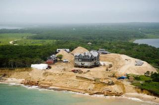
After several days of inching forward along a deep, wide sandy trench, a Chappaquiddick home arrived late Tuesday at its new location farther away from a rapidly eroding bluff.
It’s been less than a year since emergency actions began to save the Wasque home of Richard and Jennifer Schifter. The key part of the project came this week with the move of the 8,300-square-foot main house.
On a misty, windy morning in April 2007 Chris Kennedy, Martha’s Vineyard superintendent for The Trustees of Reservations, had just returned from the part of South Beach in Edgartown known as Norton Point.
The night before Katama Bay had filled to overflowing by the flood of an astronomical high tide, topped off by the overwash and storm surge of a Patriots’ Day gale.


