
Three days of stormy weather last weekend took a toll on the Island’s vulnerable beaches. Gale force winds from the north and northeast kicked up seas all around the Island.
Wave action along the Joseph Sylvia State Beach filled the channel at the Little Bridge. Sea spray often showered on Seaview avenue in Oak Bluffs.
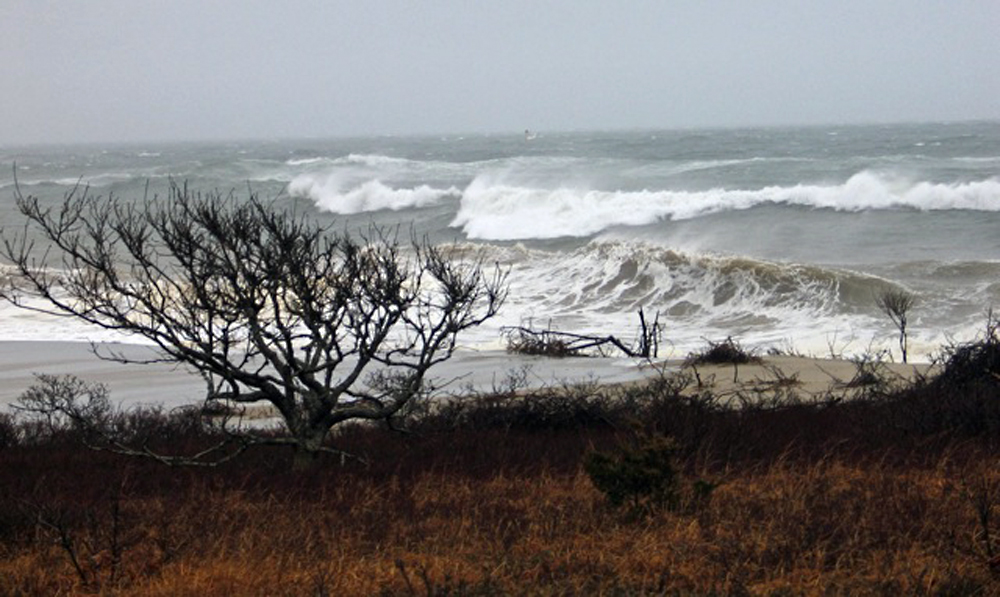
High tides and large seas rode into the sand dunes and cliffs at Squibnocket and Lucy Vincent Beaches, to surfers’ delight.
Perhaps the greatest erosion was at Wasque Point on Chappaquiddick, where at least 10 feet of land, possibly 15 feet, was washed away.
David Babson, superintendent for the Chappaquiddick unit with The Trustees of Reservations, did some measuring. He said it wasn’t just beach that was washed away, it was a once-inland area of property near a parking lot at Wasque. Mr. Babson said that as a result of the erosion, anyone taking a look on the beach might find “big pieces of sod, rootballs with trees attached, and rootballs with cedars and shrubs attached. It ripped off the bank and washed up on the beach.”
The area most affected was a parking lot known as the deflation parking lot. Not too many years ago, this parking lot on an area of elevated land was used as an area where vehicle owners were directed to let the air out of their tires before driving a couple hundred feet down to the Wasque beach.
That parking lot is now a cliff that overlooks the extremely narrow beach.
Swan Pond has continued to get more narrow, as the barrier beach that separates it from the ocean gets closer.
Mr. Babson said that East Beach, just around the bend from Wasque, also moved landward.

The impact of the erosion has changed the place, and Mr. Babson said The Trustees will spend the weeks ahead assessing what as land managers to do. “We are going to try and give people as much beach as we can, without risking safety or threatening the species that use the area and preserving habitat. It is a balancing act,” Mr. Babson said.
There were plenty of reports of flooding on the mainland due to heavy rain. The Vineyard was spared. The total rainfall for the storm was not much more than two inches, about a fourth of what was recorded in communities just outside of Boston.
Lagoon Pond Road, which is usually flooded during rainstorms, got an extra detail. A clever driver created and posted sign on the side of the road which read: “Canal Street.”
The highest wind recorded at the Martha’s Vineyard Shipyard in Vineyard Haven during the storm was 57 m.p.h.


Comments
Comment policy »