A year has passed since Richard and Jennifer Schifter took a plunge into the Vineyard unknown and moved their 8,000-square-foot house away from an eroding Chappaquiddick bluff.
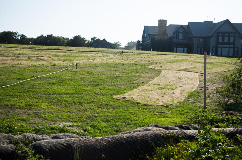
Looking back at the complex project this month, parties involved pronounce the project a success. The house now sits at a safe distance from the ocean’s fury, and a large restoration project is underway to return the property to the sandplain grassland it was meant to be.
“I would say so far, so good,” Mr. Schifter told the Gazette from his home on Thursday. “We set out to move our house to a safer location, which was accomplished without significant problem. As we complete the restoration of the landscape, we think we will have arrived at the destination we hoped to get to. It remains to be seen whether Mother Nature will cooperate, but so far, so good.”
In a recent development, Mother Nature has granted the Schifters some relief.
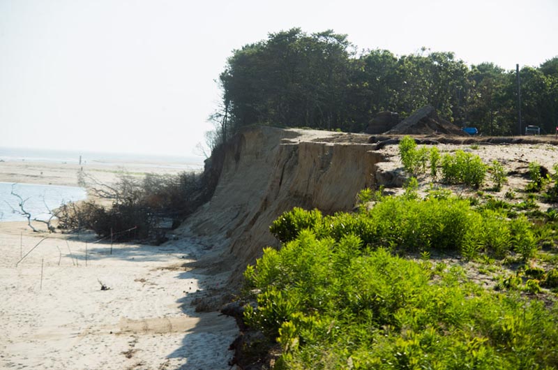
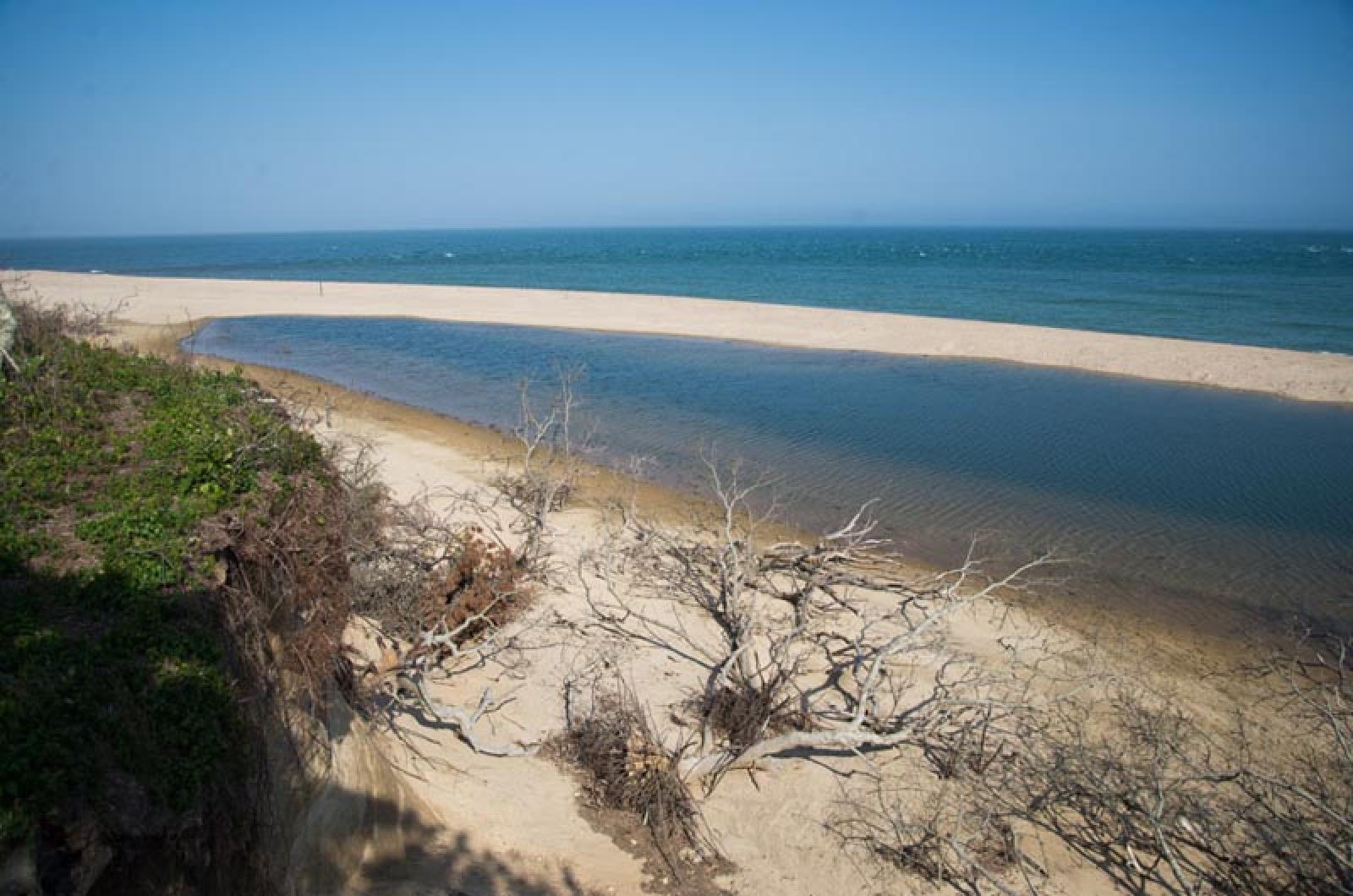
The growth of a small beach below the edge of the cliffs now provides a buffer against the tides. Erosion of the cliff has slowed to nearly a standstill as the seascape between Norton and Wasque Points shifts once again in their favor. The barrier beach originating at South Beach is also progressing eastward toward the Schifter property. Someday it will likely re-attach to Wasque, eliminating the eroding force of the tidal current which flows from the Edgartown harbor through the breach and out to sea.
The episodic breach has historically lasted for 10 to 15 years, said Jo-Ann Taylor, coastal planner for the Martha’s Vineyard Commission.
“As soon as it seals itself off, he will be sitting pretty,” Ms. Taylor said this week of Mr. Schifter. She said the barrier beach is built to withstand erosion.
The Schifter family purchased the property at the southeastern corner of Chappaquiddick in 2001. When construction of the main house was completed in May of 2007, it stood 220 feet from the edge. But what was once a property occupying a front-row seat to the drama at Wasque Point would soon acquire a starring role. A breach had formed in the Katama barrier beach in April of that year, separating Chappaquiddick from Edgartown.
The breach allowed tidal currents of high velocities to pass beside Wasque Point, increasing the vulnerability of the Schifter and neighboring Trustees of Reservations properties to coastal erosion. The corresponding disappearance of the barrier beach meant the property had lost that buffer as well. Water first reached the bluff in August 2011, and erosion began progressing at an accelerated pace in spring of 2012. The erosion rate was calculated at .87 feet a day.
Island engineer George Sourati signed onto the project in August of 2012. At the time it became clear that the house would have to be relocated.
“There was no question that if the house had stayed at its location, basically it would have fallen off the beach,” Mr. Sourati said in a recent interview with the Gazette.
The only variable was time. Thus commenced the race to acquire the necessary permits to make the move possible.

“Once the project started, it was so fast track,” Mr. Sourati recalled. “Everything fell into place when it needed to, with only a few hiccups.”
Making matters worse, the area was hit hard by two major storms. First, Hurricane Sandy came in 2012, followed by winter storm Nemo in February of 2013.
During the house move, the town granted permission for the Schifters to armor the bank with coir envelopes, fibrous rolls filled with sand and stacked on top of each other.
By the end of November of 2013, the family had moved back into the house, which was 325 feet from the edge.
The contractors moved the house as far back as possible, Mr. Sourati said. When the coir envelopes were removed, the bank lost an additional 70 feet, he said. It now stands 252 feet from the cliff’s edge, but a beach of an additional 200 feet wide has formed below.
Today attention has shifted to the project of restoring the landscape.
In order to relocate the house and neighboring structures, the contractors had to remove trees, shrubbery and topsoil from the property. All the materials were stored off-site and have now been replanted. A new meadow was re-seeded last month, and landscape architect Kris Horiuchi wrote via email that seedlings have begun to emerge. The new landscape includes 5,000 native grass plants that were part of the original landscape and 40 mature cedar trees that were harvested before the house move, plus hundreds of native shrubs including viburnums, clethra and high bush blueberry.
While no one can predict the precise future movements of the water and eroding coast out at Wasque, coastal geologists and ocean scientists studying the area have a sense of how it will likely play out.

Erosion is a pervasive theme throughout Martha’s Vineyard, though no site compares to the volatile, dynamic system at Wasque Point.
“Our situation is somewhat unique in that the erosion problem was cyclical,” Mr. Schifter said. “It was not constant, unabating erosion.”
For that reason, he said advice is hard to give to those facing a similar erosion problem, though he did offer some.
“Try to be creative in coming up with solutions to the problem you face,” he said. “And get the right professional help.”
Ms. Taylor said there is no place on the Island like Wasque Point.
“The Schifter story has no relevance anywhere else,” she said.
Elsewhere on the Vineyard, erosion is a steadier force that eats away at the coastline bit by bit.
The geology of the southern part of the Vineyard is defined by outwash plains, which feature softer sediments than those of the moraine, which dominates the northeastern and northwestern regions of the Island. As a result, the southern Vineyard shoreline erodes more easily, starting from a loss of about one foot per year near the southwestern tip, and progressing eastward to a loss of about 10 to 12 feet per year at the public part of South Beach in Edgartown.
In the 1960s, a bunker used for target practice during World War II stood at the edge of the Katama beach. Now fragmented, it stands underwater and far from shore.
The erosion will only be worsened by sea level rise, a phenomenon caused by global warming which threatens coastal communities everywhere. Sea level rise is part of a more pressing issue, which is the increasing frequency of storms, said Sterling Wall, a coastal geologist who worked on the Schifter project. Warmer waters near the Island shoreline means hurricanes can get closer to shore and do greater damage, he said.
The next large relocation effort promises to be the Gay Head Light, a project which has already hired Mr. Sourati and the International Chimney Company, the group that moved the Schifter house.
As in any seaside community, some Vineyard infrastructure is necessarily built near the ocean. Wharves, boat fuel facilities, even lighthouses have a water use that requires their precarious placement. On the opposite side of Chappaquiddick, the Cape Pogue Light was most recently relocated by helicopter in 1987.
Similarly, homeowners and assessors prize the most vulnerable land; that which is closest to sea.
With that in mind, Ms. Taylor said planning must be done to assess the vulnerability of some infrastructure and to ensure the resiliency of roads, homes and other structures in the face of coastal threats.“We can’t let fear turn us into deer in the headlights,” she said. “We have to face the future and see what we can do.”
Prior to the 2007 breach, the last opening at Norton Point closed in 1971. If history repeats itself, that means 40 years or more until the house at Wasque Point will have to be moved again.
Mr. Wall said the relocation effort has preserved the property for a certain period of extra time. “There are no guarantees,” he said. “Just because we moved it back doesn’t mean it will be safe there forever.”
Mr. Schifter said if the house has to be moved again, he hopes it will be his grandchildren who have to deal with the problem. “It’s less a question of if, than a question of when,” he said.


Comments
Comment policy »