
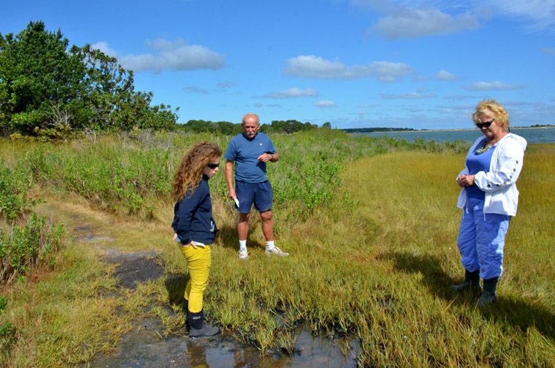
Suzan Bellincampi stood at the western edge of Sengekontacket Pond on a windy day this week. “We’ve lost eight feet, just in this area alone,” she said. Nearby, a stone bench at the edge of a small drop-off near the water has already been moved back once in the last four years.
Small waves crashed steadily into the shore — a dense mat of earth and salt marsh grass that weaves in and out along the edge of Felix Neck. Across the water, cars and trucks passed silently on Beach Road.
Storms, wind and rising seas have worn away the shoreline of the pond in recent years, leading the towns of Oak Bluffs and Edgartown, along with the Martha’s Vineyard Shellfish Group, the Martha’s Vineyard Commission and other groups, to begin taking steps to mitigate erosion and monitor the changes.
“It’s a high-energy system behind a barrier beach,” said Ms. Bellincampi, director of the Felix Neck Wildlife Sanctuary, which is now hosting two projects related to erosion and sea level rise. “We can get whitecaps out here, we get heavy winds, we get storms.”

Salt marshes are among the most productive ecosystems on earth, supporting a wide range of plant and animal life. They also serve as nurseries for finfish and shellfish, and help protect shorelines by absorbing the energy from waves. Rising sea levels have further underscored their importance on the Vineyard.
“A meter rise in sea level, we lose a quarter to a half of this property,” Ms. Bellincampi said. “If this barrier beach breaches, all of our lowlands, all of our marsh, is underwater.”
Some areas at Felix Neck, a 150-acre undeveloped peninsula between Ocean Heights and Major’s Cove in Edgartown, are better off than others, depending largely on what direction they face. Some of the trails are threatened, but so far the eroding salt marshes have not caused any damage to Island infrastructure.
The towns of Oak Bluffs and Edgartown voted in April to contribute about $9,700 each to a restoration project that will cover a total of 300 feet along the pond. The Environmental Protection Agency has also agreed to provide funding and technical support.
Oak Bluffs will lay 45 coir logs, each 10 feet long and made of dense coconut fibers, in three 100-foot stretches along the western shoreline of the pond next spring. Equal stretches of untreated shoreline will serve as reference sites. The hope is to retain sediment between the logs and the edge of the marsh, and calm the waves. The logs themselves would eventually provide a medium for salt marsh grasses such as Spartina alterniflora, which has disappeared along the edge of Felix Neck.

Coir logs are a common tool for coastal bank restoration, but this will be their first full-scale application along a salt marsh on the Vineyard. If successful, the strategy would also protect areas farther inland.
Similar efforts in the Delaware River Basin, as investigated by the EPA, will help inform the project. Other partners include the Edgartown shellfish department, the Friends of Sengekontacket and The Nature Conservancy. Felix Neck Wildlife Sanctuary plans to engage Island students and volunteers in the monitoring and replanting efforts.
A smaller project installed by the Martha’s Vineyard Shellfish Group with funding from the office of Coastal Zone Management has been underway since the spring, covering about 20 feet of shoreline at Felix Neck, and serving as a pilot for the full-scale project. It is one of four similar sites around the Island, including one on Trapps Pond, situated off the Edgartown end of Sengekontacket, and two on the Tisbury side of Lagoon Pond.

On Wednesday, shellfish group director Rick Karney checked in on the two coir logs at Felix Neck, which enclose a small indentation in the shoreline, where some biodegradable mats were collecting algae and sediment. Long nets filled with shells helped to reinforce the logs, which were held in place by ropes and wooden stakes. The shells may eventually provide a substrate for shellfish. Mr. Karney reached down and picked up a ribbed mussel. “Some of these should be planted in here with the grass,” he said, referring to the work of Island students earlier this summer. “And hopefully they’ll attach and help stabilize it a little more.”
Some of the coir logs at Lagoon Pond are starting to break down after two years, he said, noting that the technology seems to work best in areas with low-energy waves. “You’re not going to see if it’s successful for maybe two or three years,” he added. “It’s really difficult to say at the beginning. At this point we just want to see if this will stay here.” One of the goals of the larger project is to learn how the restoration efforts affect the ability of the marsh to take up nitrogen — a growing concern in coastal ponds where algal blooms have become regular events. “That was the hook to get the EPA in, to find those numbers,” said Oak Bluffs shellfish constable Dave Grunden, who wrote the grant proposal last year and will help oversee the project.
The proposal included funding for the shellfish group to continue spawning ribbed mussels, which could help to stabilize the marsh and absorb nitrogen. (That money will come from the town contributions.) The state considers the species inedible, which provides an advantage in areas such as Sengekontacket, where introducing edible species is sometimes prohibited for health reasons. “I think we’re pretty comfortable that we can get them to spawn now,” Mr. Karney said, although they take longer to grow. “We’d like to get these into a position where we can produce hundreds of thousands, or millions of them,” for shoreline protection and nitrogen mitigation, he said.
The 45 coir logs for Sengekontacket will likely arrive this fall, but the EPA has recommended waiting until the spring to install them. Over the winter, Mr. Grunden will help determine sampling protocols. Additional plantings next summer and fall will help increase biodiversity.

The various partnerships may add significant value to the project. “It’s a very fiscally responsible program,” Mr. Grunden said. “We are using about 10 grand from each of the towns, [and] we’re probably getting $40,000, or whatever it comes to, from the other entities that are now involved.” Felix Neck will use about $5,000 of the town contributions for education and outreach.
Over the years, Mr. Grunden has worked with the EPA to study bay scallop habitat, survey pond bottoms affected by algal blooms, study the effects of invasive tunicates on eelgrass, and other issues.
He believed the loss of marsh grass at Sengekontacket was at least partly a result of too much nitrogen, which he said might lead to shallower, thinner roots, and leave the plants more susceptible to erosion. The plants can grow back, he said, but erosion takes a toll. “The elevation of that chunk that’s broken off is critical,” he said. “If it’s too low, it’s submerged by the saltwater all the time and [the plants] won’t live.”
Along those lines, the MVC is working on a separate project to monitor changes in shoreline elevation. On Wednesday, MVC coastal planner Jo-Ann Taylor slogged over an area of salt marsh at the tip of Felix Neck where three large white pipes protruded about a foot from the surface. The elevation monitoring system, purchased by the Edey Foundation and installed this year with funding from the Friends of Sengekontacket, is the first of its kind on the Vineyard.
Ms. Taylor unscrewed the lid on one of the pipes, revealing a small receptacle inside, where a survey armature can be attached, spanning the three pipes, which extend about 40 feet underground for stability. The armature supports a series of vertical pins that can precisely measure changes in elevation.
Ms. Taylor and Ms. Bellincampi chose the location in part for its visibility from the trail and accessibility to students. “It will help to spread the story of what’s going on here,” Ms. Taylor said. She planned to take the first measurements in late fall, and eventually to install other systems around the Island.
Felix Neck, a Mass Audubon property, has changed little since Europeans settled here in the 1600s, which also makes it ideal for the salt marsh projects. “We expect that this marsh will be able to respond well to sea level rise,” Ms. Taylor said, explaining how the marsh would likely rise along with the sea level as a result of sedimentation. But the rate of growth is unknown.
The MVC plans to take measurements twice a year, informing other efforts on the Island. The project will run independently of the other projects at Felix Neck, but Ms. Taylor saw it as integral to shoreline protection.
“All of the assessments that we do are essential, but they’re very, very different from the other side of it, which is the strategies,” she said. “And you need both. One doesn’t work without the other.”


Comments (1)
Comments
Comment policy »