In the summer of 1991, with the scars of Hurricane Bob still visible on the Island, many public safety officials were already looking toward the future.
“My concern is that with a small-scale disaster like we had with Bob, a situation of complacency creeps in,” said Sherman Reed, a reserve worker for the Federal Emergency Management Agency (FEMA), pressing for a hurricane planning session after the storm. “It’s a losing battle to get people to think about when the big storm comes, and believe me, it will come.”

The National Weather Service took a similar approach, working with state and federal emergency management agencies to increase awareness through a series of public seminars. But it would never know whether those efforts were successful.
“It was our hope that we reached the kind of people who in turn might tend to instill a little greater consciousness,” senior National Weather Service meteorologist Robert Thompson said this week. “What’s happened is of course we’ve had 25 years go by since a landfalling hurricane, and I feel our population is especially inexperienced right now. So that is a real concern.”
A number of near misses in recent years, including Irene in 2011, Sandy in 2012 and Joaquin in 2015 have put emergency managers on heightened alert, and helped advance preparedness efforts in the state.
Over the last 100 years, Massachusetts has had a landfall hurricane about once every 10 to 15 years, making it long overdue for another.
The National Oceanic and Atmospheric Administration (NOAA), which oversees the National Weather Service, expects the strongest Atlantic hurricane season since 2012, with up to 17 named storms, including as many as four major hurricanes. NOAA has already named every potential hurricane in the Atlantic between now and 2021. There are 121 names in all, with five already crossed off the list this year: Alex, Bonnie, Colin, Danielle and Earle (only Alex and Earl became hurricanes). Next up is Fiona.
Atlantic hurricanes generally form around the equator between June and November, with the most activity in September. Their progress up the coast relies on a corresponding dip in the polar jet stream that marks the boundary between cool and warm air in the northern hemisphere.
“Just a slight change in the direction of the flow can make the difference between a hit or a miss,” Mr. Thompson said.

Areas immediately to the east of a storm tend to get less rain and more wind. In that case, the damage to boats and harbors can be severe, as it was during Hurricane Bob.
Kurt Schwartz, director of the Massachusetts Emergency Management Agency (MEMA) and a longtime Islander, points to a variety of worst-case scenarios for the Island. The most likely, he said, would be a category three storm (sustained wind speeds of 111 to 129 miles per hour), although a category four (sustained wind speeds up to 156 miles per hour) would cause catastrophic damage. A category five could leave the Island uninhabitable for months, although he said there is no precedent for such a storm in Massachusetts.
In the case of a large category three, slow-moving storm passing just to the east of the Island, Mr. Schwartz could envision large areas needing to evacuate. That would include much of the area south of Edgartown-West Tisbury Road, about half of Aquinnah and all of Menemsha. Aquinnah and Chappaquiddick would likely become islands, as they have during previous storms.
“Does the Vineyard have enough capacity to shelter those people, feed those people, rescue people that are trapped? The answer is no,” Mr. Schwartz said this week. “In the worst-case scenario, the Vineyard is going to need a lot of help from the mainland. We need to continue planning on how we are going to make that happen, and that’s true for the whole state.”
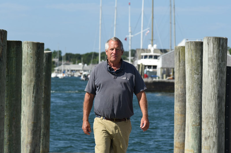
Many people on the Island who have lived through the last few hurricanes agree that no level of preparation is enough. Edgartown harbor master Charlie Blair, for example, remembers the dozens of moorings that came loose during Bob when he was a charter captain, and hopes to prevent that from happening again. But he knows it’s a losing battle.
“I kick people out of here days before the storm,” he said this week. “It’s not a good place to be.” He noted that Fairhaven and New Bedford, with their hurricane barriers, are a much safer bet for mariners.
Inland from the harbors, an updated electrical system may keep more lights on during the next big hurricane. In 2013, Eversource Energy (formerly NStar) installed larger, stronger poles around the Island, which it says will help prevent outages year-round. And a system of automated switches allows it to reroute power around damaged areas, sometimes well ahead of a crew. Since the 1990s, the company has added new undersea cables from the mainland; and a tree pruning and removal program is aimed at protecting the regional system.

Mr. Schwartz said evacuation planning at the state and local levels has also come a long way since Hurricane Bob.
“Coastal communities, their emergency managers and public safety people are much more aware of and planning for evacuations than they use to be,” he said. “What I don’t know is how engaged the public is. And part of the problem is that we haven’t had a hurricane make landfall in 25 years.”
The National Weather Service and National Hurricane Center this year unveiled new tools for communicating with the public — including storm surge maps that emphasize the risk of coastal flooding. People tend to associate hurricanes with strong winds, although far more deaths result from flooding. And plausible worst-case inundation maps, also new this year, show likely inundation zones, rather than just the immediate forecast.
“If they see the most likely scenario doesn’t look too alarming, then the temptation certainly could be to stay put,” Mr. Thompson said of the general public. “But the fact is there is enough uncertainty that we really need people to respond to that risk.”
Evacuation planning in the state also applies to northeasters, which usually involve one or two significant evacuations in the state every winter and provide some measure of how well the state could respond to a hurricane. “We know we are getting better, because it’s the same plans that we would use for a hurricane,” Mr. Schwartz said.
MEMA and FEMA work closely with the National Weather Service and local communities when a major storm takes shape, and Mr. Thompson sees that process improving as well.
“It’s on a much different level than it was in the early nineties,” he said. “Generally, if we see any risk at all, even four, five, six days out, we will start sending out messages.” What starts as an email may become a more detailed presentation and then a series of conference calls as the storm approaches.
MEMA will help evaluate the risk in each community, although towns generally decide for themselves whether to issue an evacuation order. In some cases, Mr. Schwartz might recommend to the governor that he issue an evacuation order for a town or city that doesn’t feel capable of acting on its own. He could also recommend a statewide evacuation. That hasn’t happened in his tenure, he said. “But we haven’t had landfall.”

Prior to tropical storm Sandy, the governors of Rhode Island, Connecticut, New York, New Jersey and Maryland all issued evacuation orders in their states.
Each town on the Island has its own shelter, but a regional shelter at the Oak Bluffs School would likely come into play during a hurricane. The towns are working on a memorandum of understanding to share resources to staff the Oak Bluffs shelter, although not every town has signed on.
Sandy was an eye-opener for Massachusetts, which finally joined other states in developing a standardized evacuation map (now available at mass.gov). MEMA also recently completed a study showing the likely response times needed to evacuate each town on the Island according to threat level and occupancy. In general, the Vineyard would need about 10 to 15 hours notice to safely evacuate its low-lying areas. MEMA’s Cape Cod Emergency Traffic Plan takes into account vehicles departing from the Islands, but Mr. Schwartz said the Islands themselves are a different story when it comes to traffic before a hurricane. “If we saw a powerful hurricane this time of year, there are a lot of people that are going to try to leave the Vineyard that don’t need to,” he said. “We don’t want anyone to think that Martha’s Vineyard is going to go completely underwater, and that the 80,000 or 120,000 people that are here in the summer have to get off the Island.”
Leaving the Island could also relieve the pressure on emergency managers and public safety workers during the storm, but Mr. Schwartz urged people in low-lying areas who do want to leave the Island to do so well before the hurricane arrives.
As with MEMA, Dukes County plays a largely supportive role in hurricane planning, working with the state and towns to coordinate the response, and making sure everyone is on the same page.
“One of the biggest problems with any incident is communication,” said Chuck Cotnoir, the county’s longtime emergency manager. “It can get mishandled, it can be changed. It’s essential that you have multiple transmissions of the information so you know that the information gets through.”
Technology has greatly benefitted disaster response, he said. Websites, cell phones, apps and text messaging all come into play when a storm strikes the Vineyard. Mr. Cotnoir also administers the Code Red call-warning systems for Island residents, and manages an email list-serve for residents and town officials. A number of hurricane checklists are available on the Dukes County, MEMA and FEMA websites.
Looking ahead, Mr. Cotnoir still hopes to see improved planning related to hurricane recovery, which involves maintaining a supply of food, water and other support to the Island. He said those efforts were handled well after Hurricane Bob, when thousands came together to clear brush and share supplies. But many agree that after 25 years of development, the next major hurricane will leave no less destruction in its wake.
“Response is easy,” Mr. Cotnoir said. “Recovery is usually a very long-term situation.”


Comments
Comment policy »