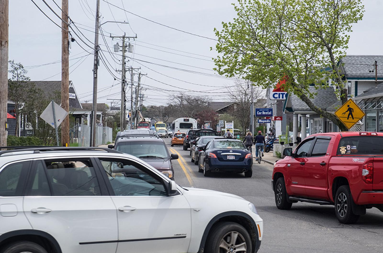
Beach Road. It is an Island lifeline, a main artery and also a nerve. After years of back and forth, the Massachusetts Department of Transportation has finalized a $5.2 million renovation plan for 2,632 feet of the coastal roadway that runs along the Vineyard Haven waterfront between Five Corners and Winds Up.
The projected completion date is 2021.
The area was identified as a missing link in Island bike and pedestrian trail access by the Martha’s Vineyard Commission in 2009. The road is especially difficult to navigate for those unfamiliar with the area. Since 2014, the town has been in talks with the state about improvements. Work was meant to be underway by 2017, but was delayed due to environmental permitting complications.
Earlier this month, Tisbury selectman Melinda Loberg and town administrator Jay Grande walked along the stretch of Beach Road targeted for improvements, pointing out areas that will change in the project that will be paid entirely with state money.
Walking side by side was impossible for much of the way. Existing sidewalks on the north side of the road are bisected by utility poles.
“I’ve seen people walk in the road with their rolling suitcases during the summer,” Mrs. Loberg said as cars zoomed by.
Interactive map; click on blue icons, top righthand corner for full view.
Under the state plan, the utility poles will be relocated or removed and the sidewalks widened.
To make the road more accessible for cyclists, car lanes will be narrowed to 10 and a half feet across with a four-and-a half-foot shoulder on each side. There also will be more spacious sidewalks on each side of the road from Five Corners to Net Result. At that point, a shared use path will begin on the south side of the road and continue to Winds Up where it will connect to the existing bike path.
Though traffic lanes will narrow, the right of way will widen overall to make room for sidewalks and a broader shoulder.
Mrs. Loberg said narrowing traffic lanes will slow down traffic and make the route safer for bikers and pedestrians. She called the phenomenon a “road diet.”
Mr. Grande estimated the project will go out to bid in 2019. It will likely take two winters to finish, with the road narrowed to one lane at a time during construction in the off season.
Some abutters will be asked to sell more than a foot of property along the roadway to accommodate the plan. The owners of the Shell Station will be asked to give up more than that. Town officials have said they hope the state can reach an agreement with landowners rather than turning to eminent domain.
The completed plan has yet to be aired in a public forum, but has drawn criticism.
Five Corners is the destination for water flowing down State Road during storms and often floods as a result. The state plan does include water diversion for water coming from uphill.
The water table in the area is naturally high.
“This area wants to be a marsh,” Mrs. Loberg said.
Sea level rise also goes largely unaccounted for in the plan, a reality planning board chairman Ben Robinson acknowledges.
“This is a project that is going to be good for 15 years, maybe 20,” he said. “Then we’re going to have to address it again in a large, comprehensive way.”
That could involve raising the road and surrounding properties significantly, as much as four feet, but even that would only buy the town another 30 or 40 years Mr. Robinson estimated. Another long-term solution could be extending the jetty at Eastville Point Beach to protect the area from storms coming from the northeast.
“If you have a little bit of sea level rise coupled with a really big storm, then you get a disaster,” he said, explaining that flooding does damage, but waves and storms destroy.
The town and the Martha’s Vineyard Commission will hold a public meeting for the state to formally present the completed plan to the Island. Commission senior planner William Veno said a date has not been set yet for the meeting.
“It will be a good opportunity for people to get an idea of what exactly is being proposed,” he said.
In Mass DOT parlance, the design plan is at the 100 per cent stage, meaning most major parts of it are set in stone, but Mr. Veno and Mr. Robinson said there is still some flexibility.
“There is still room to make some improvements,” Mr. Veno said.


Comments (14)
Comments
Comment policy »