
Martha’s Vineyard Commission planners are eyeing a significant up-Island expansion of the Vineyard’s already growing pedestrian and bicycle network, with early efforts underway to design a first-of-its-kind shared use path along historic North Road.
In a letter that went out to landowners with road frontage earlier this summer, Dan Doyle, special projects planner with the commission, said conceptual planning had begun to expand biking and walking options up-Island. After significant considerations, they concluded that North Road — a historic, six-mile road that winds through West Tisbury and Chilmark’s scenic rolling hills, farmland and fields — as the best candidate for the path.
The up-Island North Road path would connect what planners hope is eventually an Islandwide network of bicycle and pedestrian links, stretching from Edgartown to Aquinnah and traversing drawbridges, state forest and ferries along the way.
The West Tisbury-Chilmark section represents an essential artery for the planned bike path network, but presents its own array of difficulties, according to the letter.
“We are proposing a route that attempts to maintain the roadway character, through preservation of most stone walls and many geological features, while trying to account for key tree specimens and privacy issues,” the letter says in part. “We will present our work to various boards and committees in West Tisbury and Chilmark in the coming months and would welcome your input as a landowner along North Road to help us better understand how a SUP might be designed to serve the community while retaining the up-Island character. We wanted to make sure you heard from us early on.”
The conceptual proposal — still very much in its nascency — has come before the West Tisbury and Chilmark planning boards in recent weeks. Mr. Doyle and commissioner Jim Vercruysse, an Aquinnah resident, are spearheading the planning.
The path would run from the intersection of State and North roads in West Tisbury to Menemsha. The road is co-owned by the two towns; the first approximately 1.5 miles are in West Tisbury, with the rest in Chilmark.
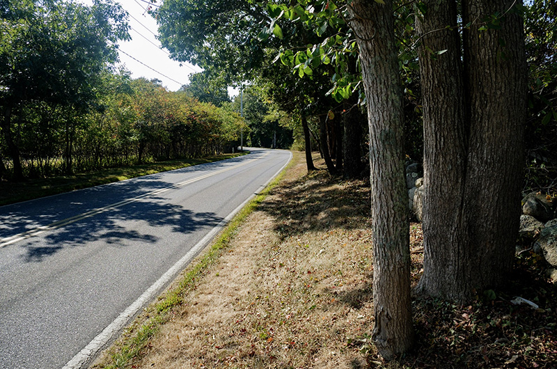
Although North Road is about 20 to 30 feet wide with a 50-foot right of way, the project would likely involve various easements to avoid cutting trees and disturbing the historic stone walls that line the roadside edges. Planners are examining options both inside and outside the right of way, as well as paved and unpaved paths. There are about 60 to 80 landowners on both the north and south sides of the road, according land surveys and assessors maps.
Mr. Doyle noted the challenge — and also the significance — of the proposal in his letter.
“To protect North Road’s character, it appears likely that numerous easements from landowners will be needed given the existing roadway layout and location of many stone walls. While this is an unconventional approach for creating a bike path on the Vineyard, there are decades of precedence in working with multiple landowners to create walking trails that cover substantial distances. A similar cooperation of landowners may be the only way a bike path can be created up-Island,” the letter says.
The Vineyard’s once-limited mishmash of semi-formal bike paths has undergone dramatic developments in recent decades through Islandwide planning initiatives spearheaded by the commission, state and town governments.
After a commission study came out in 2009 regarding shared-use paths, Tisbury’s Beach Road corridor that connects with Oak Bluffs and the hospital was identified as one of the largest down-Island gaps. In August of 2013, MassDOT hired an engineering firm to design improvements for pedestrians and cyclists along the road. Six years later, about $7.2 million in federal and state money was finally allocated for the project.
A three-year construction timeline was set to begin earlier this month.
Meanwhile, a plan to construct a path along State Road in West Tisbury that would stretch from the intersection with Old Stage Road and connect with North Road is also in the works, according to Mr. Doyle. The plans, if completed, would represent the first shared use paths up-Island, and connect down-Island paths via the Dr. Daniel Fisher Road and paths in the state forest.
In a phone interview this week, Mr. Doyle said discussions with Mr. Vercruysse regarding the North Road proposal began about a year ago, with the intention to expand the Island’s shared use path resources, particularly up-Island.
“There’s big gaping expanses up-Island with no connectivity whatsoever,” Mr. Doyle said. “We feel the deck is sort of stacked in favor of cars . . . and it’d be good to give people other choices that are safe. That’s really the motivation for it.”
Mr. Doyle said an analysis was done of the three main arteries that run pretty much parallel to one another through Chilmark — North, Middle and South roads — as well as ancient ways, to determine which would work best for a shared use path. After examining variables such as wetlands, right-of-way dimensions, the number of properties with road frontage, intersections and the terrain, North Road emerged as the preferred option.
South and Middle roads, with encroaching stone walls and high embankments, were likely too narrow, especially considering resistance among the planners to widening the road, Mr. Doyle said. North Road would give planners more flexibility, although trees and stone walls also present difficulties.
At the Chilmark planning board meeting, Mr. Doyle said a vocal contingent of residents and landowners expressed concerns about preserving the scenic road, including the tree canopy. A few residents also spoke in support of the proposal, Mr. Doyle said.
“The planning board meetings are definitely a reminder that this is going to be challenging,” he said. “People don’t want to see a single thing changed to North Road.”
The modern version of the road dates to the 1930s, and includes a variety of vistas, historic properties and eclectic sights, such as the iconic, red Mobil gas pump. But Mr. Doyle said the old road doesn’t run in the middle of the right of way, meaning the next step in the project would be to do a comprehensive road survey and mapping to determine pinch points. He said planners have no intention to disturb the stone walls, even if they are within right of ways.
The project would be eligible for Transportation Improvement Program funding, which helped finance the Beach Road SUP, according to Mr. Doyle. But it would need approval first — which remains a long way off.
“I hear an objection that is, these roads haven’t changed in forever, they are so beautiful and should be kept the way they are. I feel, let’s find a way to let people visit them in the most low impact way possible,” Mr. Doyle said. “We feel like you can still have this enchanting ride up North Road and preserve some of these viewsheds.”


Comments (38)
Comments
Comment policy »