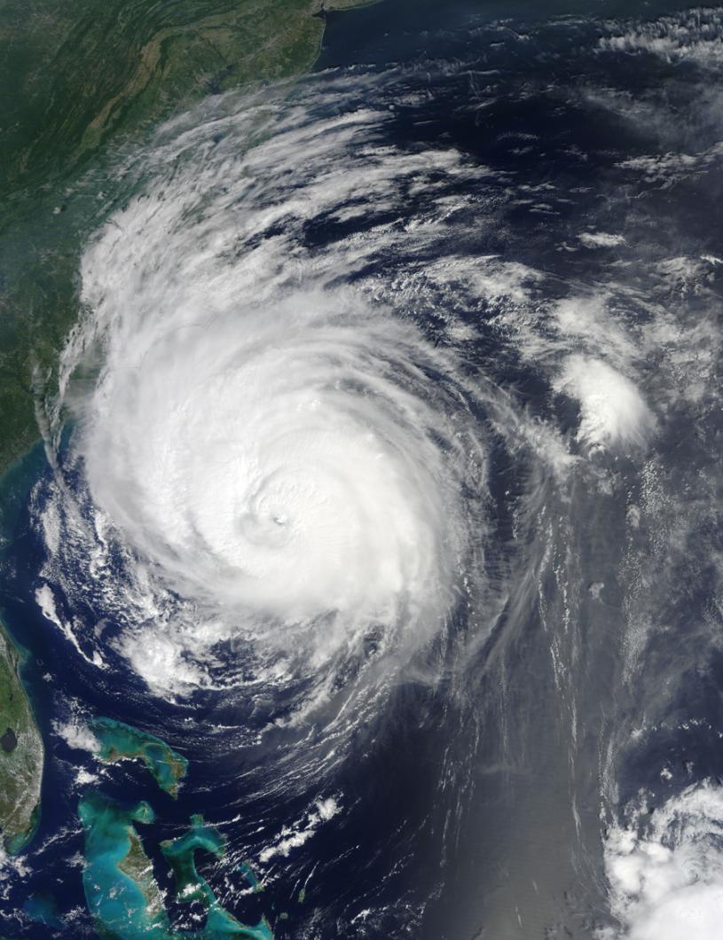
Baby Earl was born about 10 days ago, on the west coast of tropical Africa. At that stage, meteorologists called him disturbed, but not yet necessarily dangerous. They watched him closely, though, as he left that continent behind and began moving out across the Atlantic.
His first mention on the National Weather Service Hurricane Advisory Archive was on the morning of Wednesday last week, although he did not at that stage have a name.
The area of disturbed weather had passed south of the Cape Verde Islands, had become better organized and had been accorded the designation of tropical depression seven.
The weathermen noted unusually warm water in the tropical Atlantic and other conditions favorable to the depression’s intensification into a hurricane. Probably within about three days, they predicted.
Later that same day, as the depression intensified, they gave it a name: Earl, the fifth tropical storm of the season.
Earl moved westward faster than initially predicted, and grew. On Friday, the prediction was that he would turn into a category four storm. The National Hurricane Center warned that people in the Lesser Antilles should be alert.
On Saturday morning, the assessment was that Earl would reach hurricane strength within 24 hours and major hurricane strength in 72 hours.
But the forecasters also predicted that by Tuesday, Earl would encounter conditions which would halt strengthening “and possibly induce gradual weakening.”
They were mostly right.
Earl did continue to strengthen. By Sunday night, the storm’s winds were blowing at 85 knots. By Monday night, 115 knots. The people at the hurricane center said that “interests from the Carolinas northward to New England should monitor the progress of Earl. There is still considerable uncertainty as to how close the hurricane will come to the U.S. East Coast.”
But on Tuesday, when they initially thought weakening might occur, Earl remained a “well-organized hurricane” with an eye 20 miles across. And the winds were just as fierce, if not more so.
Yesterday, when the National Hurricane Center’s director Bill Read briefed media in a phone hookup, he reported that as of 11 a.m. Earl was centered 300 miles south of Cape Hatteras, packing winds of 140 miles per hour and growing in size.
The hurricane was on track to pass close to the Outer Banks of North Carolina, then accelerate up the East Coast toward the Cape and Islands, arriving here in the middle of Friday night.
He was quite definite that this would remain a serious storm. Forecasters had a “high confidence factor” that the storm would continue down its plotted track.
“We have a perfect track forecast. Nantucket, the Vineyard, probably the eastern half of the Cape will experience hurricane force winds on the western side of the eye wall,” he said.
Already the hurricane had a very large wind field, with storm force winds extending 230 miles out from the center, and hurricane force winds extending 90 miles out.
“And that may actually expand,” Mr. Read said.
“There’s some indication . . . that the storm may be getting ready to do an eye wall replacement cycle.”
He said eye wall replacement was a phenomenon in which the wall of cloud surrounding the hurricane’s eye gets surrounded by another rain band that eventually chokes off the inner eye wall, and the eye thus expands.
“Storms frequently do that when they reach large intensity. you end up with a larger eye, which spreads the hurricane force winds out,” he said.
Asked how close the eye of the storm was likely to come to the Cape and Islands, Mr. Read said: “The eye is going to be huge by then. I wouldn’t focus on the exact center of the eye, but the eye is coming very close to Nantucket.
Federal Emergency Management Administrator Craig Fugate, who also took part in the conference call, warned people not to delay in preparing for the storm.
“The message is this is a day of action,” he said .
“We expect conditions along the East Coast to deteriorate rapidly tonight and tomorrow. So people should not be lulled into a false sense that this will steer away from them.
“This is a large system, with impacts well away from the center, and time will be running out for people who have not gotten ready,” Mr. Fugate said.
There was some slightly good news late in the day, however. The Hurricane Center’s 5 p.m. report showed Earl had weakened, just a little. Winds had eased to 115 miles per hour.
Still, forecasters were predicting significant damage along the East Coast, as far up as the maritime provinces of Canada, from high seas, storm surges and strong winds, before Earl finally dies, somewhere out in the North Atlantic.


Comments
Comment policy »