

The blizzard of 2015 spared Norton Point, the long barrier beach that is about to reconnect Chappaquiddick to the rest of the Vineyard, from further breaching.
Chris Kennedy, superintendent of the Island properties for The Trustees of Reservations, reported Thursday morning that the breach remained as it was before the storm — a long tidal channel that may soon tether itself to Chappy for the first time in eight years.
“I’m standing out at Wasque Point right now at the fishermen’s parking lot,” Mr. Kennedy told the Gazette by telephone, two days after the blizzard dumped a foot and a half of snow on the Vineyard and raked the Island with hurricane-force winds. “It’s freezing, but the breach is still the same and there have been no further openings at Norton Point,” Mr. Kennedy said.
The latest maps and pictures, collected this month, showed that the lengthening spit end of Norton Point was making every effort to hook northward across the opening that separates the beach from Chappaquiddick.

When it does, Chappy will no longer be a satellite island of the Vineyard; it will be a peninsula, once again leashed to the larger Island by the three-mile barrier beach that was cut open by the Patriots’ Day storm of April 2007. That night the opening through the beach made Chappaquiddick an island off to itself — in fact, spirit and name.
“It’s made what appears to be its final turn, and it’s pointed directly at Wasque Point,” Mr. Kennedy said in an earlier interview with the Gazette on Sunday. “And if it keeps coming the way it is, it’ll probably reattach right on that rocky spit that marks the very end of Leland Beach and the northern boundary of Wasque Point. So it certainly is oriented in the right direction.”
Three days before the blizzard, he visited the southeastern corner of Chappaquiddick with Katie O’Donnell, a former assistant superintendent, on Saturday. In a wind that whipped stinging sand from the offshore beach, they watched the current race outward through the waterway from Katama Bay to the sea.
“We were there maybe at mid-tide. It was outgoing yesterday afternoon, and there’s still a lot of water going through [the channel] there. It has formed a large delta on the easterly end of it. My gut feeling is that it isn’t going to close imminently . . . but I think it’s in its final stages at this point, there’s no question,” Mr. Kennedy said.
When it occurs, the closing of the breach will close an epic Island story that began unexpectedly with a southeasterly gale eight years ago. Residents on Chappy awoke the next morning to find themselves divorced from the main island for the first time in 30 years by a watery chasm 300 feet wide, with an overburdened Katama Bay sweeping and gurgling outward to sea. A sliver of Norton Point had given way to seething winds, flooding storm surges, extreme and discordant tides, as well as a geological history that goes back periodically to the Revolutionary War at least, but almost certainly for thousands of years before that.
With Norton Point open to the sea, Chappaquiddick once again became the “separated island” that the word roughly means in Algonquin. It will remain that way until Norton Point reaches Wasque Point. Forced to hook toward Chappy by strong currents running up and down nearby Muskeget Channel, it will close, sooner or later.
Since 1870, openings have occurred naturally in 1886, 1953 and 1976. Townspeople dug open Norton Point artificially in 1921 and 1937 to freshen the shellfish beds in Katama Bay as well as to create a shortcut to the offshore fishing grounds and provide work during the Depression. Most of these openings, natural and man-made, lasted 13 to 17 years.
Data collected by Woody Filley of Chappaquiddick confirms how fast the point has grown in just the last two months.
Walking the shorelines of both Norton Point and Wasque with a GPS, Mr. Filley calculated that the point grew 850 feet to the east in the 50 days leading up to Jan. 3, and an additional 250 feet in the week between Jan. 3 and Jan. 10. “Who knows,” he wrote in an e-mail, “one of the next updates could be that it has closed.”

When it does close, beaches along the Chappy oceanfront are expected to stabilize and widen. But the opening will also leave a legacy of upheaval, loss and wonder.
For at least three years, the opening deprived the Atlantic shoreline of Chappy of the sand and beach it needed to defend its southern coast from erosion. Wasque Reservation lost some 40 acres of upland as the sea pulled down cliffs, scrub oak forests, parking lots and trails into the clawing ocean surf.
“Wasque, originally before the breach, was 200 acres in size,” said Mr. Kennedy. “So we’re certainly down to 160 acres at this point. And you know, the truth of the matter is, once that upland is gone, we’re never going to get it back. We certainly will begin to see beach begin to re-accrete. But the upland itself — that’s gone.”
The erosion imperiled two houses lying along the southern Chappy coastline. The first, belonging to Sue and Jerry Wacks near Katama Bay, stood nearly a fifth of a mile, about 1,000 feet, from the Atlantic when it was built in 1984. Today it lies about 25 feet from a cliff falling down to the channel.
A much larger home belonging to Rick and Jennifer Schifter and built at Wasque the year the opening occurred in 2007 was so endangered that in the spring and summer of 2013 it was moved back some 320 feet from the edge of the cascading cliffs.
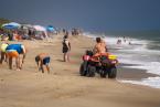
For Chappaquiddickers and townspeople, the breach has meant that for the past eight years the Chappaquiddick ferry has been the only way to drive a car or truck to or from the island. Because of this, vehicle tickets have been sold round-trip. Ferry co-owner Peter Wells said he is preparing to sell one-way tickets, with the expectation that travelers with four-wheel drive will soon have a new land bridge to the Vineyard side.
History shows that closings can be slow and irregular. The 1886 opening was reported closed at Wasque several times between 1902 and 1904. The 1953 breach took several months to close between late 1969 and early 1970.
A long opening was uncovered by David Foster, director of Harvard Forest in Petersham and a seasonal resident of West Tisbury. His research discovered an opening known to have existed in 1776 that endured for more than 90 years, with only a brief closing in 1800.
Accounts in the Gazette describe the disbelief Edgartown residents felt in January 1870 when they realized Norton Point had reconnected the two Islands. “Now the reunion seems to be permanent, and bids fair to continue so. It is nearly or quite 100 years since the passage was made by land to Chabby,” wrote the editor.
This evidence led Mr. Kennedy to wonder what the preferred state of Norton Point and Chappaquiddick might really be.
“Is it normal for Norton Point to be connected to Chappaquiddick, or as David Foster has suggested, perhaps the norm is that a breach exists?” he said. “And I have a sneaking suspicion that David might be correct. I think we should be careful about getting too used to having a direct land link, a bridge if you will, between Chappaquiddick and Edgartown.”


Comments (19)
Comments
Comment policy »