The Island coastline, representing approximately 124 miles of pristine barrier beaches, rocky shores and clay cliff faces, is the product of an ancient, hydrodynamic erosion process that has taken place over millennia.
The irony is that it can be destroyed in a second.
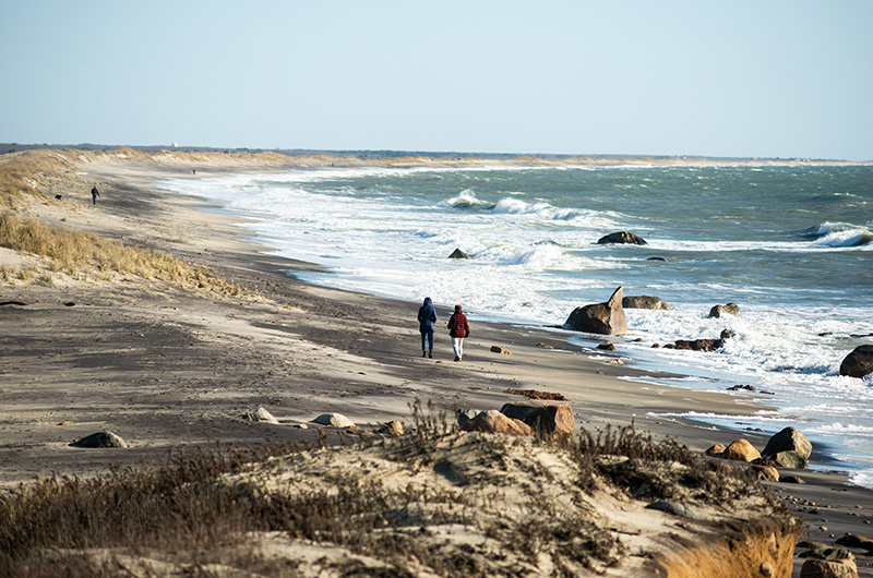
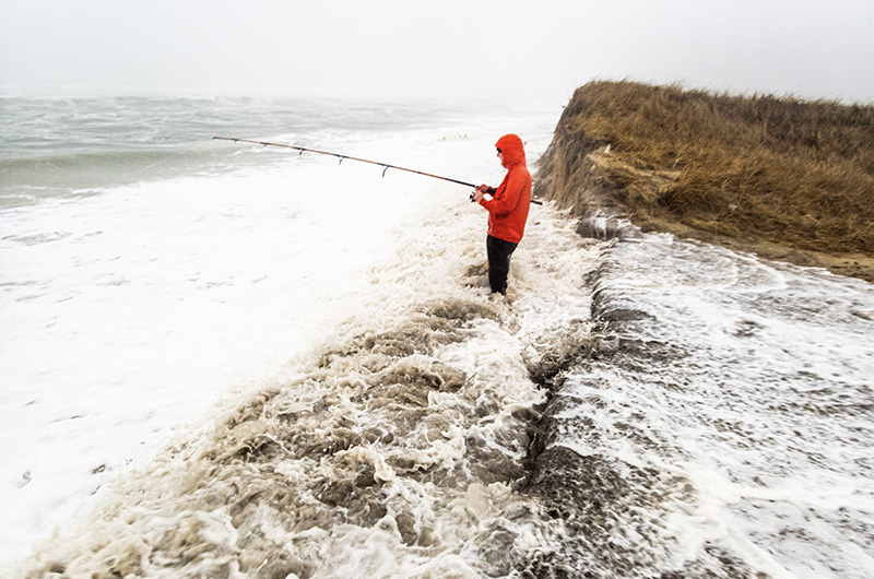
After a ferocious northeast winter storm this weekend, the fragility of that coastline — and the sheer, sublime power of the process — were on full display Monday, as high tides and storm surge turned Edgartown’s Right Fork parking lot at South Beach into a pond, barrier beaches became part of the bay and hundreds of feet of sand, silt and sediment shore disappeared into the ocean.
“[The storm] completely decimated the Right Fork dune and washed over,” said Edgartown parks department manager Jessica McGroarty. “I’ve never seen the water that high.”
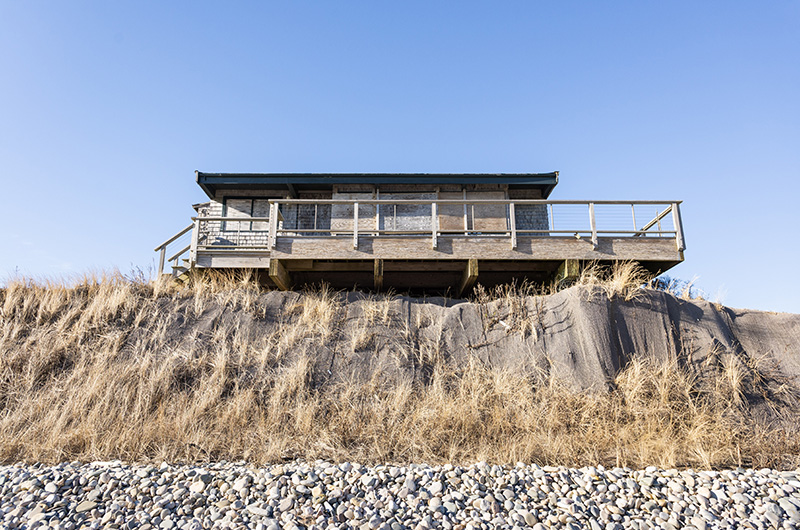
Erosion on the Island’s coastline — a process as old and familiar as the Island itself — has accelerated to a point of critical concern this winter, battering South Beach, flattening dunes in Katama, wiping away trails on Norton Point, flooding key intersections and roadways and crumbling cliffs at Lucy Vincent and Squibnocket that have withstood the changing sands of time for 10,000 years.
Known scientifically as the littoral process, the geologic erosion of coastlines and movement of sand is a natural phenomenon that has affected coastal communities up and down the Atlantic seaboard, particularly as sea levels rise, land sinks and development creeps closer and closer to the shore.
But in conversations with the Gazette, beach managers, conservationists, planners and scientists said the Island faces particularly serious threats that have only worsened in the past few years. While erosion is what created beaches in the first place, dragging sand from coastal banks to the shore, the forces now causing erosion — high winds, powerful tides and relentless ocean currents — are also destroying them. Those forces are some of the strongest on the East Coast and only getting stronger, experts said, putting new pressures on an Island not built for anthropocene-era storm surges. And unlike most coastal communities, the Island is surrounded by water, meaning erosion isn’t focused in one area, but everywhere.

“The thing that boggles my mind is that we’re trying to address these things on an Island,” said Liz Durkee, the former Oak Bluffs conservation agent who was recently hired as the Martha’s Vineyard Commission climate change planner. “Other coastal towns have one boundary that’s facing the ocean. Our entire Island is getting pummeled.”
Couple those factors with an aging road infrastructure, a hospital and ferry terminal located squarely within the flood zone, and a tourist economy entirely dependent on the existence of expansive, silt-sand beaches, and erosion poses a dire threat to an Island literally at risk for being swallowed by the sea.
“The problem with the Island and coastal erosion is that our economy is largely based on our shoreline and beach recreation, and our beaches are disappearing,” Ms. Durkee said. “And it’s not just beaches. It’s banks with houses on top of them that become endangered. And coastal roads that have gotten worn away, damaged and flooded.”
Sam Hart, regional director for the Trustees of Reservations, said the recent storm eroded nearly 200 feet of dune at Right Fork. Martina Mastromonaco, who manages Chilmark beaches, said the ocean breached Chilmark Pond at Lucy Vincent for the first time since Hurricane Sandy, with the dunes almost completely flat. An effort to fortify and rebuild Squibnocket beach has proven to be an upstream battle, and dozens of summer homes on the nearby cliff are either literally hanging over the edge or in the expensive process of being moved inland.
On the rockier north shore, armored beaches don’t have the sand to replenish themselves and State Beach gets thinner every year. The once-distant prospect of raising the key four-mile connector road, which is little more than a spit of sand, has suddenly become a nearer-term possibility.
But the impacts of erosion are perhaps nowhere as apparent as at South Beach. This past weekend, three critical intersections had to be closed when more than 300 feet of ocean overwash flooded Atlantic Drive. Once one of the Island’s largest public bathing spots, the back dune has almost entirely retreated into the flat coast, leaving the beachfront vulnerable and exposed.
“A beach is always the first line of defense from a storm,” said Tara Marden, a senior project manager and coastal geologist for the Woods Hole Group, who has been studying South Beach for 22 years. “Right now, there’s very little beach at South Beach, and it’s really steep out there. So the big waves roll in, hit the shoreline, and because the beach is so narrow, they’re impacting with the dune almost immediately.”
Ms. Marden said the flooding Monday was partially the product of three back-to-back-to-back storms in 2018 that ate away at the beach’s dune crest. The South Beach dunes have been so eroded in the past three years that even smaller storms, like Monday’s, can overtop them. The water then strips sand away, creating a vicious tidal cycle of storm and erosion.
“Waves are basically chewing into the backside of what used to be a big dune,” Ms. Marden explained. “The dunes have eroded to the point where there’s just not enough core left, there’s not enough reservoir of sand there to withstand these big storms . . . the beaches are really getting battered, more so than they have in the past.”
Compounding the problem is the fact that any effort to nourish the beach is largely sacrificial, Ms. Marden said, meaning that engineers would need hundreds of thousands of yards of sand to even start the rebuilding process — much more than successful nourishment projects at Bend in the Road Beach facing Nantucket Sound. Ms. Marden also recently did a study modeling the wave energy offshore at South Beach for the Trustees and said the results were “incredible.”
“Some of the highest wave energy on the East Coast,” she said. “And that’s why when you go out there right now, the dunes are completely eroded away and you’ve got flooding in the roadway 300 feet back.”
Despite those challenges, a flurry of capital projects have received state coastal zone management grant funding this year to address the impacts of erosion. More than $220,000 went to a joint Oak Bluffs and commission project to map storm tide pathways in low-lying areas across the Island; Tisbury received $110,000 for coastal planning and nearly $60,000 has gone to Edgartown to nourish the left fork dune and relocate the existing changing rooms.
The project includes removing 150 feet of asphalt roadway just off the coastal dunes, returning them to their natural state and installing a removable boardwalk over the restored natural habitat. Shovels are expected to go in the sand by spring of 2022.
If there’s any sand left.
“Every time we have a storm you don’t know what to expect,” said Ms. Mastromonaco in Chilmark. “It’s just changing . . . you can’t get sad about it because you can’t stop the ocean.”


Comments (3)
Comments
Comment policy »