
The three pounding winter storms that took a toll on the Island’s south shore also have scientists who study the area pondering retreat.
The Woods Hole Oceanographic Institution had tens of thousands of dollars of ocean and meteorological monitoring equipment along Edgartown’s South Beach damaged in the storms from Dec. 18, Jan. 9 and Jan. 13. Other sensors that have been up for more than 20 years have been removed because of the eroding shoreline, prompting WHOI to reconsider where it can safely place its equipment.
Going back to 2001, the Woods Hole scientific institution has had cables running from the Katama Airfield to monitors along the beach. In 2003, a tower about two miles offshore started recording wave heights and other oceanographic measurements.
Collectively known as the Martha’s Vineyard Coastal Observatory, the equipment is one of the only such meteorological and oceanographic setups in the region and it has helped bolster academic research around the Island. Air temperature, wind speed, wave heights and a live feed of the beach are among several different things recorded by the observatory.

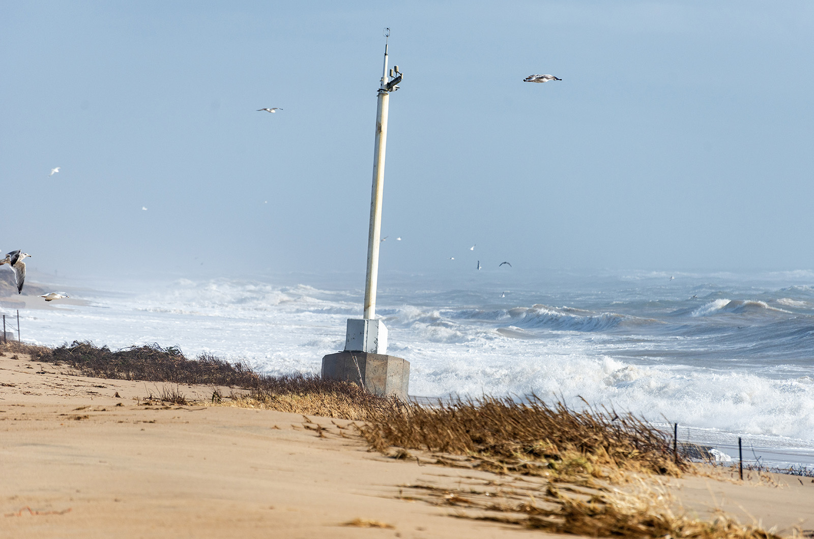
For beachgoers, WHOI’s 30-foot tall meteorological mast has been a regular sight on the shore, situated next to the town’s lifeguard shack. But it had to be taken off the beach for want of stable footing on the fast shrinking shoreline.
“It ripped up the beach and put our equipment at risk,” said Anthony Kirincich, a senior scientist at the WHOI who oversees the observatory.
Along with providing scientific data to WHOI, the broadcasted livefeed allowed people a glimpse of the waves and beach crowds before heading down to the shore. The underground cables also provided power to the town lifeguard building.
After the storms, in which the WHOI observatory recorded waves as high as 24 feet offshore, Edgartown declared a state of emergency and has been trying to get federal funds to help with the recovery.
Officials said last week it wasn’t clear if Massachusetts would receive any aid, but the town has started working to restore the beach and revive the crumbling Atlantic Drive. The town has dredged Katama Bay and Herring Creek and recently dropped new piles of sand along Left Fork.
While that work is ongoing, WHOI remains in a holding pattern to see how erosion and restoration efforts settle, allowing a safe location to reinstall its equipment.
WHOI says it will be crucial in the coming years to have the observatory running at full capacity to observe any potential ocean changes as offshore wind turbines are installed south of the Vineyard.
“It’s a valuable research area for us,” Mr. Kirincich said. “It provides a long-term record of the local climate.”
Some of the equipment has been temporarily put up at the Katama Airfield and WHOI is in conversation with the town to talk about potential solutions.
“We definitely want to be back out there with them,” Mr. Kirincich said.


Comments (1)
Comments
Comment policy »