
Drive into Five Corners in Vineyard Haven from any direction and one is confronted with a hodgepodge of commerce and signage, and a confusing array of asphalt options.
A neurologist might call it over-stimulation. Islanders just call it a big old mess.
A recent study by the Martha’s Vineyard Commission put the intersection at the top of the list for vehicle accidents on the Island. This was not news to anyone, as navigating the area requires both patience and the will to dive into the unknown.

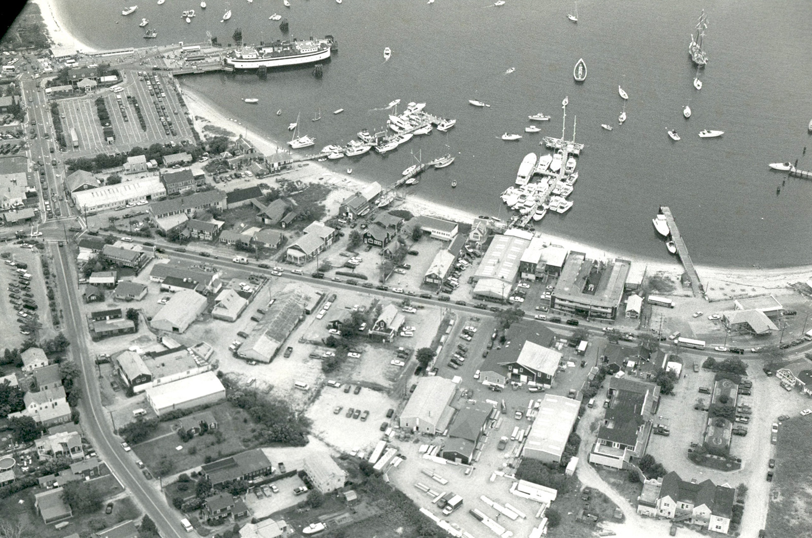
And yet the entire area was once a safe harbor, literally, when it went by the name of Bass Creek, a water filled channel that connected the main harbor to the Lagoon.
According to Bow Van Riper, the research librarian at the Martha’s Vineyard Museum, the channel was wide and deep enough in 1771 to allow the town’s whaling fleet to moor in Lagoon Pond.
A barrier beach by the Lagoon also helped provide shelter for smaller ships.
“Ferries from Falmouth would drop people off at the foot of Beach Street and, if it was the last trip of the day, it would anchor in the protection of the barrier beach which is now that tiny island behind Beach Road,” said Mr. Van Riper.
Digging deeper into the history reveals a slow accretion of details rather than the arrival of some grand plan. The result is an odd welcome mat for the Vineyard, with tourists streaming from the Steamship Authority terminal, rolling past Stop & Shop, and then immediately confronted with an ungainly decision tree of towns to visit and the mileage it takes to get there.
By foot, there’s a crosswalk leading to Cumberland Farms and the post office, another crossing Lagoon Pond Road where a bike shop, paint store and Wicked Caning reside.

And that little street leading to the Black Dog Tavern, the harbor and other assorted businesses? It’s called Beach street Extension, although that’s a test most Islanders would probably fail.
The roots of today’s Five Corners began around 1815, when a hurricane chewed through the barrier beach to the Lagoon creating two openings and turning Bass Creek into a shallow narrow channel, severely eroding its utility.
By 1835, town residents decided there was no longer much use for Bass Creek, and they envisioned buildable lots and commerce in its place. After a lengthy debate, voters decided the creek should be filled. The first attempt was disrupted by a severe northeaster, so in 1838 a decommissioned sloop named the Zephyr was moved and sunk at the foot of Beach Street, so-called because it ran from the top of Main Street literally to the beach.
Townspeople lent a hand and “every man and boy in the village turned out to help fill the schooner with earth and rocks,” according to an early Vineyard Gazette account.
That new earthen corridor allowed the construction of a wharf a block up from Five Corners and townspeople, according to Mr. Van Riper, could now walk and drive along the front of the village. By 1840, he said, the basic plan of the Five Corners intersection was in place.
Other expansions and innovations led to much of what we see today. Developers in Cottage City wanted more direct access to Vineyard Haven, so a causeway was built to what would become the Marine Hospital in 1900 and now the home of the Martha’s Vineyard Museum.
That row of small houses along Lagoon Pond Road across from Chicken Alley thrift store? They were once waterfront properties. Into the 1920s, water ran up the southern edge of that stretch, right up to the doorstep of what is now the paint store and the bike shop.

Mr. Van Riper said that from the late 1930s to 1946 that area was filled in and commercial development emerged in and around the harbor. There was a blacksmith, an ice making company, oil tanks and another commercial operation that packed salted codfish.
Dukes County Garage already anchored the corner, opening in 1913 where it remained until the Douglas family bought the property in 1974.
Today, any rainstorm turns back the clock, as Five Corners has become a notorious flood zone threatening to return to its watery past. The stormwater run-off and the corresponding narrow outflow to the harbor led former Tisbury Selectman Tristan Israel to once remark: “It’s like trying to take a bucket of water and pour it into a small soda bottle.”
A couple of developments over the years certainly contributed to the flooding issues. In the 1950s, the wetland adjacent to Lagoon Pond Road was filled in to create playing fields and a park. And in 1954, the First National supermarket began construction where the post office and Cumberland Farms stand today. Both the wetlands and the open field helped soak up stormwater, said Mr. Van Riper, but an entire corner of asphalt offers no relief, just more runoff.
Today the town is working in partnership with the University of New Hampshire Stormwater Center to create a larger underground basin to allow for better water flow. The idea is to combine three existing catch basins into a single underground structure at the beach.
When the work will begin, let alone end, still remains to be seen. But for now the intersection remains a test for nearly every visitor to the Island.
Martha’s Vineyard, a place of tranquility? Maybe, eventually, but not before white knuckling it through Five Corners.


Comments (4)
Comments
Comment policy »