
Tick Free MV, the new Island nonprofit aiming to tackle tick-borne illnesses and allergies by reducing the Vineyard’s tick population, has announced it will begin a thermal drone survey of the Island’s deer population this weekend.
From Feb. 15 to March 7, the public can expect overnight drone activity as the aircraft fly all over the Vineyard in a grid pattern, using infrared cameras to detect the Island’s deer hotspots.
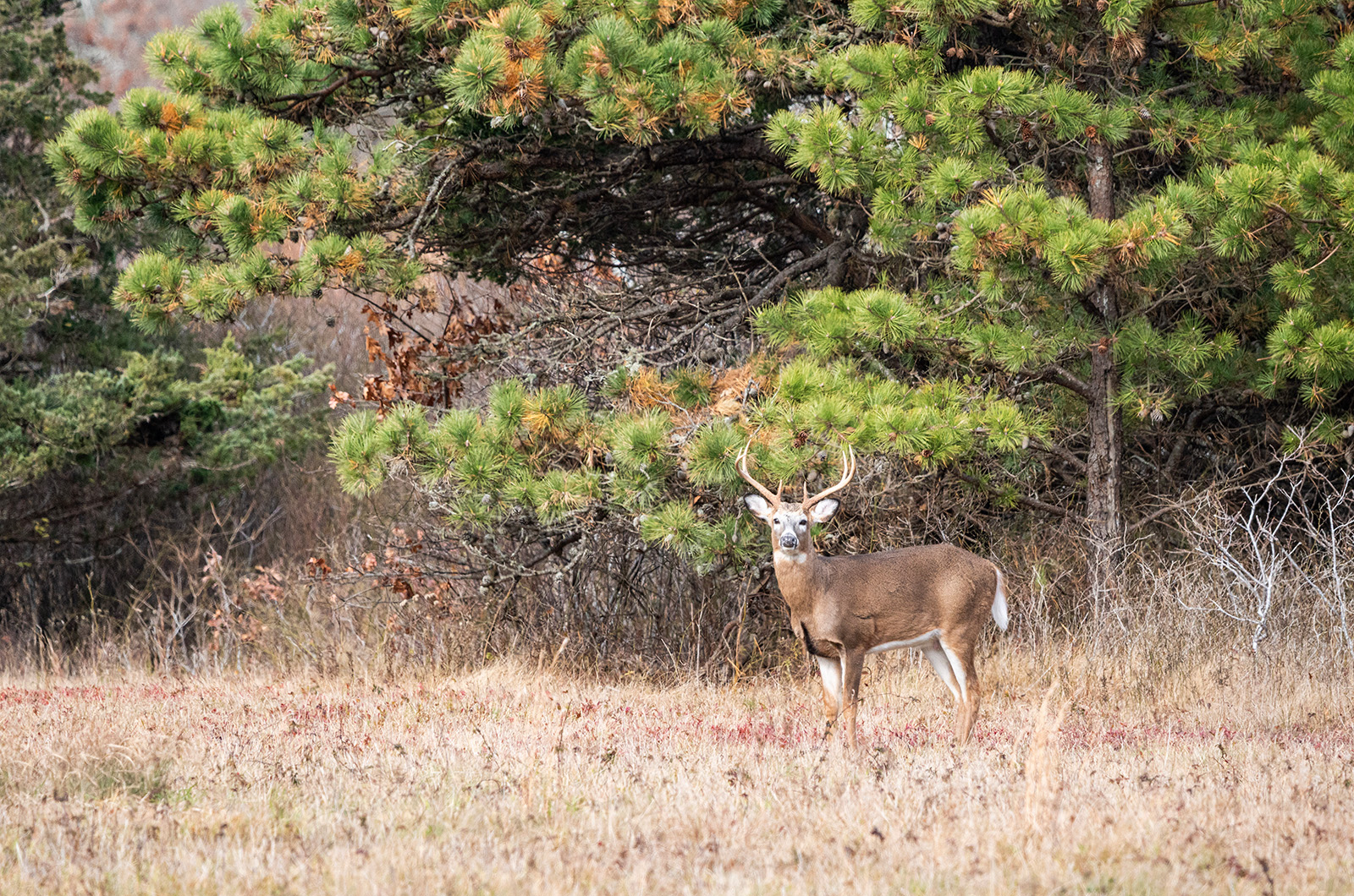
Tick Free MV first announced plans for the survey when the organization officially launched in December. The strategy is part of an array of initiatives the group is pursuing to see if targeting the Island’s deer density, which is far above state recommendations, could be a way to curb the proliferation of ticks by cutting down the arachnids’ main food source.
“The survey is designed to collect baseline data on the Island’s deer population size and distribution,” reads a statement shared by Tick Free MV executive director Virginia Barbatti.

“Deer are a key host in the tick life cycle, and the Vineyard experiences some of the highest rates of tick-borne diseases and allergies in the country. Accurate deer population data is a foundational input for informed public health and land-management decision-making.”
The group contracted wildlife management company White Buffalo to conduct the survey. White Buffalo’s Jason Boulanger will oversee the operation on the Vineyard.
According to Ms. Barbatti, White Buffalo will interpret the data it collects, and Tick Free MV will make the findings publicly available. Tick Free MV does not yet know how it will proceed after receiving the data, she said.
“At this point, our main goal with the data is to get it into people’s hands, because we want our community to understand or to have facts around what’s happening on the island,” Ms. Barbatti told the Gazette by phone. “We’ve made it pretty clear as an organization that we see the high deer densities on the island as a major contributing factor to the tick overabundance that’s happening here and the resulting surge of tick borne disease and allergies that we’re facing.”
“Understanding as much as we can about that deer population to inform what we might want to do as a community will be important,” she added.
Over the past several weeks, Tick Free MV has approached the Island’s six towns, the Wampanoag Tribe of Gay Head (Aquinnah) and the Marthas Vineyard Land Bank to request locations for drone launch and landing. Five towns and the tribe have been supportive thus far, with Tisbury set to vote on Tuesday. Some private landowners have given permission too, Ms. Barbatti told the Gazette.
“We were so appreciative of each of the six towns granting some amount of access,” she said. “There will be over 100 individual launch sites we’ve gotten permissions for, and that’s a combination of … public lands and private lands.”
The unmanned drones will be piloted by Federal Aviation Administration (FAA)-certified pilots and comply with FAA regulations, per the press release. Mr. Boulanger said the drones will remain in FAA-controlled airspace as they fly over private properties and should not cause major disturbances.
“The aircrafts are relatively quiet and will be in the air only as long as needed to complete the surveys, keeping disturbance to a minimum,” he wrote to the Gazette.
He also maintained that the close proximity of Martha’s Vineyard Airport to Manuel F. Correllus State Forest will not prevent drones from collecting accurate data on the forest’s deer distribution.
“Our drone operators continuously monitor nearby air traffic during flights and will always give way to any manned aircraft,” he wrote. “Because operations occur at night in Class G airspace, air traffic in the area is typically very limited. We will be flying over the Manuel F. Correllus State Forest, but not over the [MVY] airport property.”
He said the company has drone insurance in case anything goes wrong.
“In the unlikely event of an accident, we would immediately contact local authorities,” he wrote.
Conducting the survey after the extended deer hunting season ends on Feb. 14 will give experts a clearer idea of the population that remains. Mr. Boulanger noted that winter’s leafless trees and cold ground make it hard for deer to hide.
“Winter is ideal for drone-based deer counts because cold nights create strong thermal contrast that makes animals’ body heat stand out clearly against a uniformly cold background, and leaf-off conditions open up sightlines through the forest canopy for better detection,” Mr. Boulanger wrote.
If heat signatures of humans out late at night turn up, White Buffalo will disregard the data.
“The survey does not capture identifiable images of people, faces, or homes, and the sole purpose of image review is to confirm and count deer,” the statement reads.
Ms. Barbatti feels the drone survey is an important step in giving Islanders the facts of the Vineyard’s tick crisis.
“The more our island community knows about our unique circumstances, the better, from our perspective,” she said.


Comments (15)
Comments
Comment policy »