
How Martha's Vineyard Has Developed Over Five Decades


Thursday, August 1, 2019
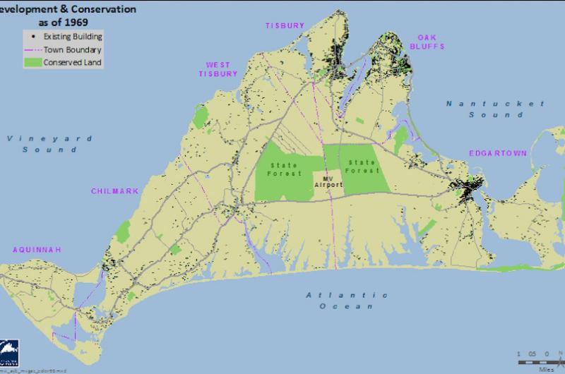
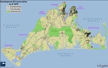
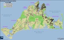
Maps show growth of development and conservation land on Martha's Vineyard over the last 50 years, from 1969 to 2019. Special thanks to cartographer Chris Seidel of the Martha's Vineyard Commission.


Comments
Comment policy »