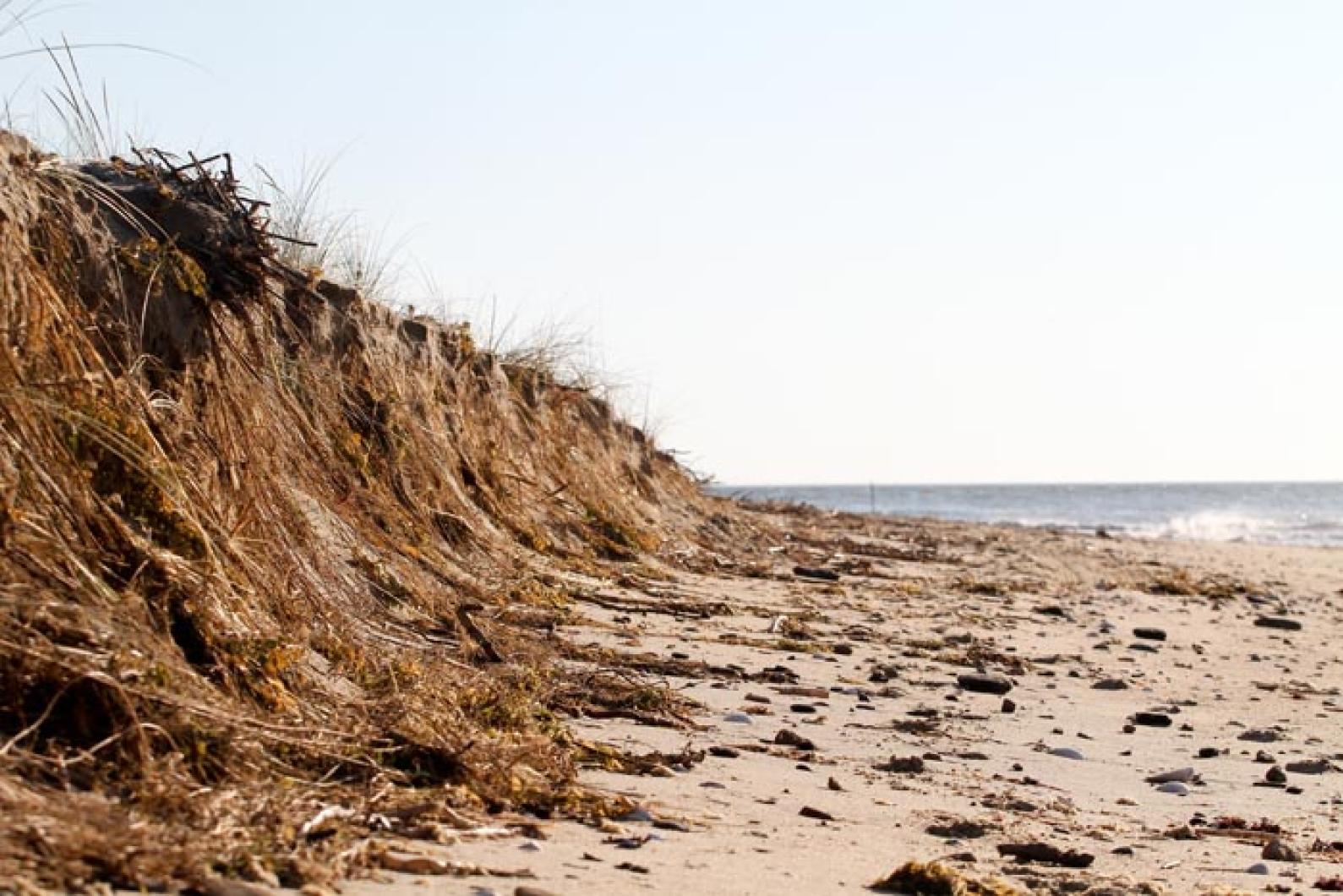
While tropical storm Irene did little damage inland save a good salt blasting and natural pruning of trees, the storm drastically reshaped parts of the Island’s coastline when it blew through last Sunday. At Wasque Reservation on Chappaquiddick, 22 feet of south-facing beach fell into the ocean in a 24-hour period. And around the Island conservation officials reported significant losses of beachfront and dramatically altered shorelines. Beaches that were wide ribbons of sand just last week are now nothing but rocks and boulders, and vice versa.
On Thursday Katie O’Donnell, Wasque Beach superintendent for The Trustees of Reservations, surveyed the uprooted tree-strewn landscape of the beach and spoke about the scene like someone returning to a war zone.
“That’s our old well,” she said pointing to a pipe poking up from the surf. “It used to be in the middle of the parking lot.” All told, Ms. O’Donnell said 75 feet of beach had been lost at Wasque this summer.
Three beachgoers had plopped down their foldable chairs on the sliver of parking lot left at the edge of the shore. One Trustees ranger on a day off with fishing rod in hand, took in the scene in disbelief.
“What happened?” said Vinny Viglione. “I leave for a week and everything’s changed!”
Swan Pond, visible on Google Earth, is completely gone. All that remains of the former marsh are a few bricks of peat scattered along the beach. The boardwalk that curved around the elbow of Wasque is a mangled helix and atop the bluff, trails terminate at sheer drop-offs.
“On Friday this trail went down along the water’s edge and there was a fork that went down to fishermen’s beach,” said Ms. O’Donnell, standing at a dead-end path.
At the Norton Point breach, the Chappaquiddick side lost some 500 feet of beach in the storm according to measurements taken by Katama resident Dana Gaines using GPS. Ms. O’Donnell estimated that the beach on the Edgartown side had gained nearly as much. Meanwhile, the beach on the Chappaquiddick side of the breach has begun to curl inward like a beckoning finger; Ms. O’Donnell thinks it may soon connect to the island, forming a new salt pond.
There was significant erosion on the north shore of the Vineyard as well from Irene.
At Great Rock Bight in West Tisbury, Martha’s Vineyard Land Bank property manager Matthew Dix said the storm dramatically altered the beachfront cliffs.
“There’s a lot of exposed clay now,” he said. “Years ago it was all covered by natural sand and the past few years it was covered by landslide. The loamier material was on top and the bushes slid down covering the clay. Now that’s been scoured away.”
At the Wilfrid’s Pond Preserve near Tashmoo, Mr. Dix said six feet of beach was lost.
At Cedar Tree Neck Wildlife Sanctuary, Sheriff’s Meadow Foundation executive director Adam Moore reported damaged dunes while farther down-Island some West Chop residents were surprised to find their beaches augmented by fresh sand deposits.
But back on the south shore, at Moshup Beach in Aquinnah the waves and wind had stripped away all the sand.
“It looks like a winter beach now, it’s almost all rocks,” Mr. Dix said.
In Woods Hole scientists from the Coastal Systems Group are taking a broader view of such changes. In the run up to Hurricane Irene, researchers like Andrea Hawkes scrambled to deploy dozens of sediment traps, drilling what looked like nylon socks to telephone poles and stop signs along Surf Drive in Falmouth to collect overwash from the storm. By measuring the grain size of deposits and measuring the wind and water velocity, scientists can reconstruct the intensity of historic storms, whose records lie in the barcode like layers of sediment in nearby ponds.
“It’s always great to measure a modern event at your site because it gives you the parameters in which to gauge the past,” Ms. Hawkes said.
Pulling sediment cores from oceanfront ponds, Woods Hole scientists are able to view a 2,000-year archive of great New England storms, with strata of organic matter punctuated by thin layers of sand that represent violent storms.
“The 1635 hurricane is usually readily observable,” Ms. Hawkes said, referring to the huge storm that pummeled the Jamestown and Plymouth colonies.
Other storms were lost to history only to be rediscovered by sediment analysis.
“There was a pretty big one about 1,500 years ago,” Ms. Hawkes said, adding: “The idea is that when we look in the past we get an idea of what are the periods of time when hurricanes were more frequent or more intense. It helps us see, if we’re moving toward a warmer climate, whether we are going to enter another phase of that system.”
One of her most visible sand layers is from 1938; the historic September hurricane that year tore a gash at Norton Point that did not close until 1952.
Meanwhile, back at Wasque several hundred yards out, just a few feet beneath the surf lie the seeds for Chappaquiddick’s eventual, if partial, recovery. Here a sand bar is forming, just as in the years following 1938. It extends from Norton Point and runs parallel to Wasque. Eventually, Ms. O’Donnell predicted, the sand bar will curve around to Wasque and reattach to Chappaquiddick, creating a new Swan Pond. And eventually Norton Point will again become an isthmus to Edgartown. But the damage to the south shore will be done.
“I think it’s been really neat watching how things have changed,” said Ms. O’Donnell. In the background the threatened home of Jerry and Sue Wacks sat ever closer to the breaking surf. “But it’s been really traumatizing for a lot of people.”


Comments (1)
Comments
Comment policy »