
From the July 27, 1928 edition of the Vineyard Gazette:
Perhaps at sometime in the distant future, the Island of Martha’s Vineyard may be referred to as Greater Martha’s Vineyard. That this has never yet been done seems strange in certain respects, as the Vineyard consists of three distinct bodies of land separated from one another by water of sufficient depth to prohibit wading. A bridge now connects Gay Head and Quitsa with the main part of the Island but Chappaquiddick is cut off from the Vineyard by deep unbridged water, and traffic between Edgartown and this little island is dependent upon small ferry boats, one of which is maintained by the town.
There are forty houses or more on the island and the summer population is estimated at between two hundred and fifty and three hundred. In winter there are but twenty-five people there.
Included in the town of Edgartown in the island’s history is interwoven with that of the town to a great degree but its location apart from the mainland of the Vineyard has necessitated the establishment of certain customs and habits by the inhabitants which would not have been necessary had the two bodies of land been joined. Because of this isolation Chappaquiddick has its own particular traditions and folk-tales.
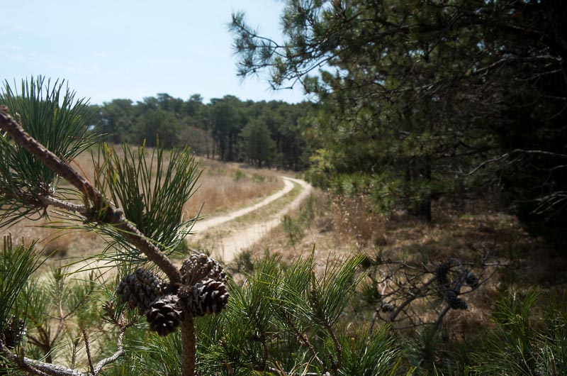
Landing from the skiff which does duty as a ferry, the visitor finds himself near the bathing beach which is patronized by all of Edgartown. A very good dirt road, red and smooth, stretches away into the interior, rising as it reaches the hills. The topography of Chappaquiddick is much like that of the Vineyard proper, save that the land is not as high, the hills more gently sloped.
Crossed by numerous roads, Chappaquiddick is an easy place to explore. While the island is thickly dotted with farms and summer places, those on the western side nearest Edgartown are comparatively new for the most part, consisting of summer homes, some large and pretentious, others just camps. There are a few old houses and the empty cellar holes where others have stood but apparently the settlement of other days was on the seaward side of the island to the northeast.
The main road leads in a winding way from the ferry landing to the northeast beach of the island near Tom’s Neck and the farm of Benjamin Pease, but before this is reached there is much interesting country to travel through. The road is very smooth, for there are a number of cars on the island. Descending into hollows and valleys, all sight of the sea is shut out at times even though the sound of boats’ motors in Edgartown harbor may be heard. Here are found the old houses, several of them long since abandoned and left to fall to decay.
By the side of the road stands a tall post built into a fence. Apparently placed there to support a driveway gate, it still stands straight and true although the gate and road itself have disappeared. Close examination shows that this post is the jaw bone of a great sperm whale. Many have spoken or written of the “whales rib” gate post, and perhaps anther was meant, but on the estate of the late Thomas Huxford, the post thus spoken of is a whale’s jaw with the tooth sockets plainly showing in the aged bone.
Not far from here is Tom’s Neck Farm, the home of Mr. Pease, who has been previously mentioned, and here are further interesting sights to be seen and explained by a native son of the island. The farm house is an interesting one. More than sixty years ago Mr. Pease’s grandfather, then a man of ninety, told his grandson that the house was an old one when he himself was a boy. This is not difficult to believe, for every detail and angle of the inside finish speaks of extreme age.
From the Tom’s Neck Farm a road extends to the southward through the center of the island, passing a few small farms where a huge pair of ox cart wheels are weathering in a field. The school house is also on this road, a small building, not very old but once holding forty pupils, Indian and white. The road ends at the estate of John Jeremiah, the largest on the island, but near the end there are several other roads branching off and running to both east and west. The easterly road goes to the beach and to the famous “blue rock” of the treasure story so often told, where no one can dig without being frightened away by the apparition of the pirate who buried the hoard.
The other roads wind about through the woods and high scrub oak. Here are the birds, hundreds of them, gathered to nest and to feed on the wild berries that abound. Every sandy spot shows the traces of the birds, for there is nothing to disturb them here.
And so down toward the shore once more, down to the red road and the bathing beach, the sparkling, blue waters of Edgartown harbor, the speed boats and fishing craft and the blue-painted ferry of Capt. James Yates. A hot trip on a summer day, a rather hard hike for the untrained, but there is no traffic, no interference and no dust.
Compiled by Hilary Wall
library@mvgazette.com


Comments
Comment policy »